Marine Charting & Cartography
-
 Humminbird®LakeMaster™ Plus Wisconsin V3 microSD Format Electronic Chart (600025-8)LakeMaster™ Plus Wisconsin V3 microSD Format Electronic Chart by Humminbird®. The Humminbird LakeMaster PLUS Wisconsin Edition micro map card has added over 500 new lakes, 45 High Definition - Surveyed waters to now boast contours for...i-Pilot® Link™ compatibleEasy to read contours$179.99
 - Humminbird®LakeMaster™ Quebec V1 microSD Format Electronic Chart (600055-1)LakeMaster™ Quebec V1 microSD Format Electronic Chart by Humminbird®. The NEW Humminbird LakeMaster Quebec Edition, Version 1, micro map card with SD adapter is loaded with contours for over 1,000 lakes within Quebec. Ready for your...Includes maps of Gouin Reservoir, Ottawa River, Richelieu River, Lake Champlain, St Lawrence River, Lac St Jean, Lac Témiscaming, Saguenay River, and Lac MistassiniAlso includes many High Definition maps for lakes in the Laurentian region$179.99
- Humminbird®LakeMaster™ Southeast States V5 microSD Format Electronic Chart (600023-8)LakeMaster™ Southeast States V5 microSD Format Electronic Chart by Humminbird®. The Humminbird LakeMaster Southeast States Edition, Version 5, has added over 230 new lakes since the prior version – more than 160 in High Definition....LakeMaster micro SD card with adapter includes depth contour information and features such as Depth Highlight, Shallow Water Highlight and Water Level Offset, which can be used exclusively with Humminbird fish findersNew High-Definition lake map data available for the following lakes: Dale Hollow, Green River, Martin, Sidney Lanier, Watts Barr, Weiss and more$179.99
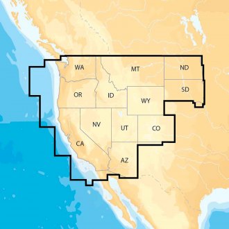
- Humminbird®LakeMaster™ US West V3 microSD Format Electronic Chart (600011-4)LakeMaster™ US West V3 microSD Format Electronic Chart by Humminbird®. The new Humminbird LakeMaster Western States Edition Map Card combines the best fishing waters for Arizona, California, Colorado, Idaho, Montana, New Mexico,...Engineered to high standardsHigh-grade design delivers extended lifespan$179.99
- Humminbird®LakeMaster™ Wisconsin V8 microSD Format Electronic Chart (600025-7)LakeMaster™ Wisconsin V8 microSD Format Electronic Chart by Humminbird®. The Humminbird LakeMaster Plus Wisconsin Edition micro map card has added over new lakes. Surveyed waters to now boast contours for a total of over 1,700 lakes...Engineered to high standardsHigh-grade design delivers extended lifespan$179.99
- Humminbird®SmartStrike™ Dakotas-Nebraska V2 microSD Format Electronic Chart (600034-2)SmartStrike™ Dakotas-Nebraska V2 microSD Format Electronic Chart by Humminbird®. The Humminbird SmartStrike Dakotas/Nebraska Edition, Map Card features many of the best fishing waters in North Dakota, South Dakota and Nebraska, all on...Engineered to high standardsHigh-grade design delivers extended lifespan$239.99
- Humminbird®SmartStrike™ Great Lakes microSD Format Electronic Chart (600035-3)SmartStrike™ Great Lakes microSD Format Electronic Chart by Humminbird®. Great Lakes (MI, IN, OH, KY, TN). The Humminbird SmartStrike Great Lakes Edition, Version 3 Map Card combines many of the best fishing waters in Indiana, Ohio,...Engineered to high standardsHigh-grade design delivers extended lifespan$239.99
- Humminbird®SmartStrike™ Midsouth States V4 microSD Format Electronic Chart (600037-4)SmartStrike™ Midsouth States V4 microSD Format Electronic Chart by Humminbird®. The Humminbird SmartStrike Mid-South Edition, Version 4, has added over 65 new lakes since the prior version – 60+ in High Definition. Additionally, it...SmartStrike provides LakeMaster depth contours and includes features such as Depth Highlight, Shallow Water Highlight and Water Level Offset, while also providing predictive fish information based on your specific conditionsSmartStrike takes you straight to the action by showing you where the fish should be biting on any of the High Definition lakes of your choice. Based on search parameters like season, time of day, temperature and targeted fish species, SmartStrike highlights areas of the lake map where your prey is most likely to be located - before you even wet a line$239.99
- Humminbird®SmartStrike™ Souteast States V4 microSD Format Electronic Chart (600039-4)SmartStrike™ Souteast States V4 microSD Format Electronic Chart by Humminbird®. The Humminbird SmartStrike Southeast States Edition, Version 4, has added over 230 new lakes since the prior version – more than 160 in High Definition....SmartStrike provides LakeMaster depth contours and includes features such as Depth Highlight, Shallow Water Highlight and Water Level Offset, while also providing predictive fish information based on your specific conditionsSmartStrike takes you straight to the action by showing you where the fish should be biting on any of the High Definition lakes of your choice. Based on search parameters like season, time of day, temperature and targeted fish species, SmartStrike highlights areas of the lake map where your prey is most likely to be located - before you even wet a line$239.99
- Humminbird®SmartStrike™ US Great Plains microSD Format Electronic Chart (600036-2)SmartStrike™ US Great Plains microSD Format Electronic Chart by Humminbird®. Great plains (IA, IL, KS, MO, NE). The Humminbird SmartStrike Great Plains Edition, Version 2 Map Card combines many of the best fishing waters in Iowa,...Engineered to high standardsHigh-grade design delivers extended lifespan$239.99
- Maptech®Chesapeake Bay to Florida V5 Guide (CGCBF-05)Chesapeake Bay to Florida V5 Guide by Maptech®. 5-th Edition. Cape May and Delaware Bay through the Chesapeake and Intracoastal Waterway, and offshore to the St. Johns River in northern Florida. Packed with detailed listings for...Engineered to high standardsHigh-grade design delivers extended lifespan$31.58
- Maptech®Chesapeake and Delaware Bays V14 Chart Kit (R04-14)Chesapeake and Delaware Bays V14 Chart Kit by Maptech®. Region 4, 14-th Edition. Completely updated. Coastal and offshore coverage. Full-color charts, GPS waypoints, courses and distances, Yeoman points, and color aerial photos. Save...Expertly crafted from premium materialsDesigned to match rigorous quality standards$163.39
- Maptech®Delaware Bay and the C-D Canal V2 Waterproof Chart (WPC047)Delaware Bay and the C-D Canal V2 Waterproof Chart by Maptech®. 2-nd Edition. Cape May, NJ to Wilmington, DE and Elk River, MD. Featuring GPS Waypoints, courses and distances, and fishing and wreck sites. 24" x 36", scale 1:108,000 with...User-Friendly, Flip-Fold FormatKey Symbols and Finding Your Way Tips$17.53
- Maptech®Little Egg Harbor NJ to Cape May NJ V2 Waterproof Chart (WPC035)Little Egg Harbor NJ to Cape May NJ V2 Waterproof Chart by Maptech®. 2-nd Edition. Beach Haven, Little Egg, Brigantine, Absecon, Great Egg Corson, Townsends, Hereford and Cape May inlets. Featuring GPS Waypoints, courses and distances,...User-Friendly, Flip-Fold FormatKey Symbols and Finding Your Way Tips$28.98
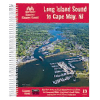
- Maptech®Long Island Sound to Cape May V15 Guide (CGLIS-15)Long Island Sound to Cape May V15 Guide by Maptech®. 15-th Edition. New York Harbor to Block Island, Long Island's South Shore, the Hudson River, and New Jersey's coast from Raritan Bay to Cape May. Packed with detailed listings for...Engineered to high standardsHigh-grade design delivers extended lifespan$34.57
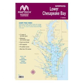
- Maptech®Lower Chesapeake Bay V3 Waterproof Chart (WPC026)Lower Chesapeake Bay V3 Waterproof Chart by Maptech®. 3-rd Edition. Smith Point to Chesapeake Approaches. Featuring waypoints for major buoys, courses and distances, and ramp locations and information. Great planning chart. 24" x 36",...User-Friendly, Flip-Fold FormatKey Symbols and Finding Your Way Tips$28.98
- Maptech®New York to Nantucket and to Cape May New Jersey V17 Chart Kit (R03-17)New York to Nantucket and to Cape May New Jersey V17 Chart Kit by Maptech®. Region 3, 17th Edition. Maptech's ChartKits™ are full-color reproductions of NOAA charts bundled together in large cruising regions. ChartKits™ have been a...90 Chart PagesA Great Value You’ll save up to 90% compared to the cost of purchasing individual government charts$169.03
- Maptech®Norfolk Va. to Florida and the Intracoastal Waterway V14 Chart Kit (R06-14)Norfolk Va. to Florida and the Intracoastal Waterway V14 Chart Kit by Maptech®. Region 6, 14th Edition. Norfolk, VA, to Fernandina Beach, FL, inside and outside. Includes ICW navigation advice and Bridge Table. Full-color charts, GPS...Expertly crafted from premium materialsDesigned to match rigorous quality standards$163.39
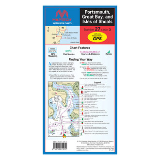
- Maptech®Portsmouth Great Bay and Isles of Shoals V3 Waterproof Chart (WPC027-03)Portsmouth Great Bay and Isles of Shoals V3 Waterproof Chart by Maptech®. 3-rd Edition. Great Bay and Piscataqua River to Isles of Shoals. Featuring GPS Waypoints, courses and distances, ramp locations, state parks, and fishing areas....User-Friendly, Flip-Fold FormatKey Symbols and Finding Your Way Tips$17.02
- Maptech®Sandy Hook, NJ-Atlantic City, NJ Chart (WPC034)Sandy Hook, NJ-Atlantic City, NJ Chart by Maptech®. This product is made of high-quality materials to serve you for years to come. Designed using state-of-the-art technology and with customers in mind. It will meet your needs and...Engineered to high standardsHigh-grade design delivers extended lifespan$28.98
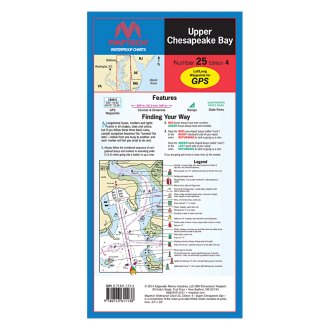
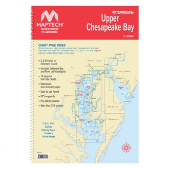
- Maptech®Upper Chesapeake Bay V4 Waterproof Chart (WPC025-04)Upper Chesapeake Bay V4 Waterproof Chart by Maptech®. 4-th Edition. C&D Canal to the Potomac River. Featuring waypoints for major buoys, courses and distances, and ramp locations and information. Great planning chart. 24 x 36, scale...User-Friendly, Flip-Fold FormatKey Symbols and Finding Your Way Tips$28.98
- Maptech®WPB Long Island Sound V5 Chart Kit (WPB0325-05)WPB Long Island Sound V5 Chart Kit by Maptech®. 5-th Edition. Covers the entire Sound from Throgs Neck to Block Island and Point Judith. Easy-to-use format includes cruising facility information, GPS waypoints and magnetic tracks with...Expertly crafted from premium materialsDesigned to match rigorous quality standards$69.64
- Maptech®WPB Lower Chesapeake Bay Waterproof Chart Kit (WPB0440-01)WPB Lower Chesapeake Bay Waterproof Chart Kit by Maptech®. 1-st Edition. Solomons Island to Norfolk, Va. Offers full-color charts on waterproof, tear-resistant pages. Easy-to-use format includes GPS waypoints, pre-plotted courses and...Expertly crafted from premium materialsDesigned to match rigorous quality standards$90.12
- Maptech®WPB South Shore Long Island V4 Chart Kit (WPB0340-04)WPB South Shore Long Island V4 Chart Kit by Maptech®. 4-th Edition. South Shore Long Island NY Harbor's Lower Bay to Montauk and Block Island. Easy-to-use format includes GPS waypoints, pre-plotted courses and more than 300 marinas. 27...Expertly crafted from premium materialsDesigned to match rigorous quality standards$69.64
- Maptech®WPB Upper Chesapeake Bay Waterproof Chart Kit (WPB0430-01)WPB Upper Chesapeake Bay Waterproof Chart Kit by Maptech®. 1-st Edition. Covers C&D Canal to Solomons Island and includes Delaware Bay and River to Phildelphia. Offers full-color charts on waterproof, tear-resistant pages. Easy-to-use...Expertly crafted from premium materialsDesigned to match rigorous quality standards$90.12
- Navionics®HotMaps Platinum Lake Maps Canada microSD Format Electronic Chart (MSD/HMPT-C6)HotMaps Platinum Lake Maps Canada microSD Format Electronic Chart by Navionics®. The most comprehensive lake charts! Advanced features help you quickly target the best spots and catch mone fish! Check out the detailed Naulical Chart...Lake ChartsOne foot contours$206.99
- Navionics®HotMaps Platinum Lake Maps East microSD Format Electronic Chart (MSD/HMPT-E6)HotMaps Platinum Lake Maps East microSD Format Electronic Chart by Navionics®. The most comprehensive lake charts! Advanced features help you quickly target the best spots and catch mone fish! Check out the detailed Naulical Chart plus...Lake ChartsOne foot contours$249.48
- Navionics®HotMaps Platinum Lake Maps North microSD Format Electronic Chart (MSD/HMPT-N6)HotMaps Platinum Lake Maps North microSD Format Electronic Chart by Navionics®. The most comprehensive lake charts! Advanced features help you quickly target the best spots and catch mone fish! Check out the detailed Naulical Chart plus...Lake ChartsOne foot contours$213.66
- Navionics®Navionics Updates North America microSD Format Electronic Chart (MSD/NAVU-NI)Navionics Updates North America microSD Format Electronic Chart by Navionics®. Simply use your compatible card from Navionics, C-MAP, Fishing Hot Spots, Garmin, LakeMaster, Lowrance, Magellan and TrakMaps to activate Navionics Updates....Marine and lake chartsOne foot contours$99.00
- Navionics®Navionics+ US West CF Format Electronic Chart (CF/NAV+WE)Navionics+ US West CF Format Electronic Chart (CF/NAV+WE) by Navionics®. Navionics+ Regions is a powerfull chart solution providing more regional marine and lakes content than any other product on the market! Get derailed Nautical...Marine and lake chartsOne foot contours$169.16


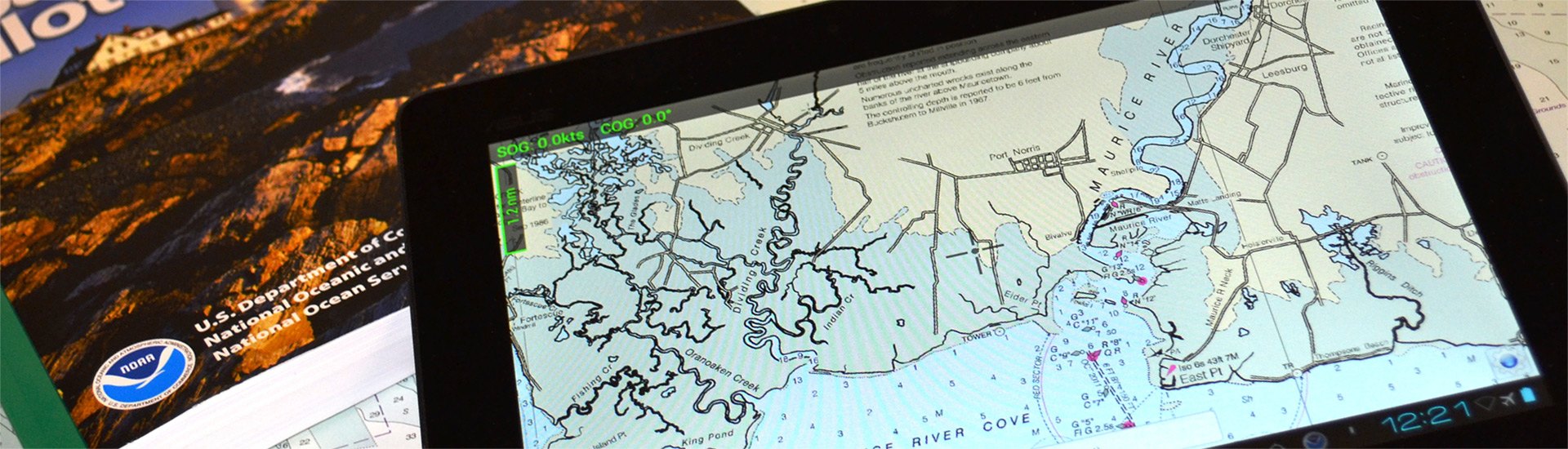
A safe boating experience cannot be imagined without nautical maps. Though conventional paper marine maps are still used on every boat, new technologically-advanced electronic charts have made the entire map reading and course planning routine much easier. So what is electronic cartography? The definition is pretty straightforward - electronic charts are digital versions of the most dependable government-issued paper charts and maps crated to simplify your navigation.
The data that is used by electronic charts comes from a number of government sources including NOAA, Canadian Hydrographics, and many others. Electronic charts give mariners greater possibilities on the water, providing you with innovative object-oriented cartography. Normally the electronic charts are displayed on chartplotters, multifunction displays (smartphones) or personal computers. Chartplotters, that are typically waterproof, are usually opted for when you own smaller 40’-50’ boats, while tablets and smartphones are well-suited for larger sail and power boats. PCs are usually used on large vessels and commercial boats.
Electronic charts are available in a number of formats: dynamic raster scanned charts (Maptech) that are basically direct video images of paper charts. They are precise and reliable versions of conventional paper charts. Vector charts (Garmin, Navionics, C-Map) typically take less memory as they have the information transformed into coordinates in a data file. Vector charts are “object oriented”, so when a cursor is positioned over icons, numerals, words or other features, additional windows with detailed descriptions will pop up. New generation 3D maps with high-definition relief will provide you with improved underwater view.
Electronic charts for chartplotters are usually available on small microSD memory cards that can be inserted into a GPS unit. In their turn, smartphone and PC charts are downloadable. While the paper maps show signs of heavy use, over time signaling you to get a newer version, the electronic chart will look brand new, but may pose danger when outdated. Thus, your electronic maps should be regularly updated and kept current to provide greater level of protection against marine hazards. Either used for recreational and commercial boating or fishing, interactive electronic charts will help you make the most of your boating experience.