Marine Charting & Cartography
-
 C-MAP®NT+ TN River Paducah-Knoxville C-Card Format Electronic Chart (NA-C041)NT+ TN River Paducah-Knoxville C-Card Format Electronic Chart by C-MAP®. C-MAP NT+ cartography helped launch a digital charting revolution years ago, and it is still as useful and reliable as ever. For fishermen, sailors and cruisers...Full-featured vector charts: C-MAP NT+ provides boaters with the accurate, up-to-date vector chart detail including Depth Areas and Contours, Spot Soundings, NavAids, Light Sectors, Wrecks/Obstructions, Small Craft Facilities and moreHarbor and approach details: The detail and information available with C-MAP NT+ charts lets boaters approach any harbor and inlet with confidence - the perfect conclusion to a long voyage, sailing adventure or exciting day of bluewater fishing$257.94
 - Davis Instruments®Artificial Horizon (144)Artificial Horizon by Davis Instruments®. Answers the need of every sextant user who cannot depend on a natural sea horizon. Use for backyard practice, finding exact positon when inland, and making exact sextant shot on foggy mornings....Engineered to high standardsHigh-grade design delivers extended lifespan$44.63
- Davis Instruments®Mark 15 Sextant (026)Mark 15 Sextant (026) by Davis Instruments®. This model has many great features including seven large sunshades, a 3 mm x 27 mm star scope, and easy-to-read micrometer drum vernier scale that reads to 2/10 of a minute. The Mark 15 has a...Engineered to high standardsHigh-grade design delivers extended lifespan$288.21
- Davis Instruments®Mark 25 Sextant (025)Mark 25 Sextant (025) by Davis Instruments®. The top of the line Davis plastic sextant, the Mark 25 features our Beam Converger™ mirror, sometimes referred to as a “full horizon mirror”. A special coating is applied to high...Engineered to high standardsHigh-grade design delivers extended lifespan$331.45
- Davis Instruments®Mark 3 Sextant (011)Mark 3 Sextant (011) by Davis Instruments®. Sometimes referred to as a “lifeboat” sextant, the Mark 3 is an inexpensive training sextant. Yet this model has taken sailors around the world, too! It is full-sized and has sunshades,...Engineered to high standardsHigh-grade design delivers extended lifespan$86.83
- Davis Instruments®Parallel Rules (061)Parallel Rules by Davis Instruments®. Completely transparent clear optical finish allows for exact plotting. Each 15? (38 cm) blade features large, easy-to-grip handles. Precision molded for accurate straight line plotting.Engineered to high standardsHigh-grade design delivers extended lifespan$17.01
- Furuno®C-MAP Mega Wide North/Central America Pacific Coast MM3 Format Electronic Chart (MM3-VNA-035)C-MAP Mega Wide North/Central America Pacific Coast MM3 Format Electronic Chart by Furuno®. This Chart Pack includes vector charts, 3D data and standard resolution satellite photography for the US and Canadian Pacific Coast, Hawaii,...Engineered to high standardsHigh-grade design delivers extended lifespan$562.80
- Furuno®Canada Atlantic Coast-Gulf of Mexico-Caribbean-Bahamas MM3 Format Electronic Chart (MM3-VNA-033)Canada Atlantic Coast-Gulf of Mexico-Caribbean-Bahamas MM3 Format Electronic Chart by Furuno®. This Chart Pack includes vector charts, 3D data and standard resolution satellite photography for the US and Canadian Atlantic Coast, Gulf of...Engineered to high standardsHigh-grade design delivers extended lifespan$562.80
- Furuno®Canada North & East MM3 Format Electronic Chart (MM3-VNA-021)Canada North & East MM3 Format Electronic Chart by Furuno®. This Chart Pack includes vector charts, 3D data and standard resolution satellite photography for North East Canada. C-Map chart data is used and converted to the TimeZero...Engineered to high standardsHigh-grade design delivers extended lifespan$281.40
- Furuno®Central America-Caribbean MM3 Format Electronic Chart (MM3-VNA-027)Central America-Caribbean MM3 Format Electronic Chart by Furuno®. This Chart Pack includes vector charts, 3D data and standard resolution satellite photography for Central America, the Caribbean and part of Mexico. C-Map chart data is...Engineered to high standardsHigh-grade design delivers extended lifespan$281.40
- Furuno®Costa Rica-Chile-Falklands MM3 Format Electronic Chart (MM3-VSA-500)Costa Rica-Chile-Falklands MM3 Format Electronic Chart by Furuno®. This Chart Pack includes vector charts, 3D data and standard resolution satellite photography for Costa Rica to Chile to Falklands. C-Map chart data is used and...Engineered to high standardsHigh-grade design delivers extended lifespan$281.40
- Furuno®Great Lakes & Maritimes MM3 Format Electronic Chart (MM3-VNA-026)Great Lakes & Maritimes MM3 Format Electronic Chart by Furuno®. This Chart Pack includes vector charts, 3D data and standard resolution satellite photography for Great Lakes and Maritimes. C-Map chart data is used and converted to the...Engineered to high standardsHigh-grade design delivers extended lifespan$281.40
- Furuno®NavNet 3D Gulf of Mexico-Great Lakes MM3 Format Electronic Chart (MM3-VNA-023)NavNet 3D Gulf of Mexico-Great Lakes MM3 Format Electronic Chart by Furuno®. This Chart Pack includes vector charts for Gulf of Mexico, Great Lakes, and Rivers, plus standard resolution satellite photography for part of the Great Lakes....Engineered to high standardsHigh-grade design delivers extended lifespan$281.40
- Furuno®US East-Bahamas MM3 Format Electronic Chart (MM3-FNA-022)US East-Bahamas MM3 Format Electronic Chart by Furuno®. This product is made of high-quality materials to serve you for years to come. Designed using state-of-the-art technology and with customers in mind. It will meet your needs and...Engineered to high standardsHigh-grade design delivers extended lifespan$112.56
- Furuno®US East-Bahamas-Bermudas MM3 Format Electronic Chart (MM3-VNA-022)US East-Bahamas-Bermudas MM3 Format Electronic Chart by Furuno®. This Chart Pack includes vector charts for United States East Coast, Bahamas and Bermuda, plus standard resolution satellite photography for the Bahamas. C-Map chart data...Engineered to high standardsHigh-grade design delivers extended lifespan$281.40
- Furuno®US West-Hawaii MM3 Format Electronic Chart (MM3-VNA-024)US West-Hawaii MM3 Format Electronic Chart by Furuno®. This Chart Pack includes vector charts for US West Coast, Hawaii and Baja Mexico, plus standard resolution satellite photography for Baja Mexico. C-Map chart data is used and...Engineered to high standardsHigh-grade design delivers extended lifespan$281.40
- Humminbird®Contour Elite™ Midsouth States V5 DVD Format Software (600010-5)Contour Elite™ Midsouth States V5 DVD Format Software by Humminbird®. Contour Elite lets you access High Definition Humminbird LakeMaster lake data on your PC. Advanced features, combined with a user-friendly interface, let you search...Contour Elite is the only computer program that lets you view the incredible detail of Humminbird LakeMaster High Definition lake mapsCreate a customized search by entering species, time of year, sets of pre-defined criteria, or your own custom search parameters to find the lake's best locations$141.59
- Humminbird®LakeMaster™ Dakotas-Nebraska V6 microSD Format Electronic Chart (600013-5)LakeMaster™ Dakotas-Nebraska V6 microSD Format Electronic Chart by Humminbird®. Version 6 The Humminbird LakeMaster Dakotas Nebraska Edition combines many of the best fishing waters for North Dakota, South Dakota, and Nebraska all on...Engineered to high standardsHigh-grade design delivers extended lifespan$179.99
- Humminbird®LakeMaster™ Great Lakes microSD Format Electronic Chart (600015-6)LakeMaster™ Great Lakes microSD Format Electronic Chart by Humminbird®. Great Lakes (MI, IN, OH, KY, TN). The unmatched accuracy and detail of Humminbird LakeMaster give you a serious edge. Patented features include the ability to...Engineered to high standardsHigh-grade design delivers extended lifespan$239.99
- Humminbird®LakeMaster™ Great Plains microSD Format Electronic Chart (600017-5)LakeMaster™ Great Plains microSD Format Electronic Chart by Humminbird®. Great plains (IA, IL, KS, MO, NE). The unmatched accuracy and detail of Humminbird LakeMaster give you a serious edge. Patented features include the ability to...Engineered to high standardsHigh-grade design delivers extended lifespan$179.99
- Humminbird®LakeMaster™ MidAtlantic V2 microSD Format Electronic Chart (600043-3)LakeMaster™ MidAtlantic V2 microSD Format Electronic Chart by Humminbird®. The Humminbird LakeMaster Mid-Atlantic Edition, Version 2 micro map card has added over 60 new lakes, 45 High Definition - Surveyed waters to now boast...i-Pilot® Link™ compatibleEasy to read contours$179.99
- Humminbird®LakeMaster™ Minnesota V9 microSD Format Electronic Chart (600021-9)LakeMaster™ Minnesota V9 microSD Format Electronic Chart by Humminbird®. The Humminbird LakeMaster Minnesota Edition, has added new lakes since the prior version. In all, this version boasts more than 700 High Definition lakes and...LakeMaster micro SD card with adapter includes depth contour information and features such as Depth Highlight, Shallow Water Highlight and Water Level Offset, which can be used exclusively with Humminbird fish findersNew High-Definition lake map data available for the following lakes: Bemidji, Gull Lake Chain, Leech, Mille Lacs, Minnetonka, Vermilion, Winnibigoshish and more$179.99
- Humminbird®LakeMaster™ NorthEast V2 microSD Format Electronic Chart (600045-3)LakeMaster™ NorthEast V2 microSD Format Electronic Chart by Humminbird®. The Humminbird LakeMaster NorthEast Edition, Version 2 micro map card has added over 200 new lakes, 27 High Definition - Surveyed waters to now boast contours...i-Pilot® Link™ compatibleEasy to read contours$179.99
- Humminbird®LakeMaster™ Plus Dakotas-Nebraska V2 microSD Format Electronic Chart (600013-6)LakeMaster™ Plus Dakotas-Nebraska V2 microSD Format Electronic Chart by Humminbird®. The unmatched accuracy and detail of Humminbird LakeMaster give you a serious edge. Patented features include the ability to select and highlight a...i-Pilot® Link™ compatibleEasy to read contours$239.99
- Humminbird®LakeMaster™ Plus Great Lakes microSD Format Electronic Chart (600015-7)LakeMaster™ Plus Great Lakes microSD Format Electronic Chart by Humminbird®. The Humminbird LakeMaster Great Lakes Edition, Version 4 micro map card has added over 140 new lakes, 50 High Definition waters to now boast contours for a...Updated shallow water areas for Lake Michigan and parts of Lake SuperiorFull coverage of Lake Superior$179.99
- Humminbird®LakeMaster™ Plus Great Plains microSD Format Electronic Chart (600017-4)LakeMaster™ Plus Great Plains microSD Format Electronic Chart by Humminbird®. Great plains (IA, IL, KS, MO, NE). The unmatched accuracy and detail of Humminbird LakeMaster give you a serious edge. Patented features include the ability...i-Pilot® Link™ compatibleEasy to read contours$239.99
- Humminbird®LakeMaster™ Plus MidAtlantic V2 microSD Format Electronic Chart (600043-4)LakeMaster™ Plus MidAtlantic V2 microSD Format Electronic Chart by Humminbird®. The Humminbird LakeMaster PLUS Mid-Atlantic Edition, Version 2, micro map card with SD adapter has added over 60 new lakes since the prior version - 15 in...i-Pilot® Link™ compatibleEasy to read contours$239.99
- Humminbird®LakeMaster™ Plus Minnesota V4 microSD Format Electronic Chart (600021-10)LakeMaster™ Plus Minnesota V4 microSD Format Electronic Chart by Humminbird®. The Humminbird LakeMaster Minnesota PLUS Edition micro map card has added over 1,000 new lakes, 81 High Definition - Surveyed waters to now boast contours...i-Pilot® Link™ compatibleEasy to read contours$239.99
- Humminbird®LakeMaster™ Plus NorthEast V2 microSD Format Electronic Chart (600045-4)LakeMaster™ Plus NorthEast V2 microSD Format Electronic Chart by Humminbird®. The Humminbird LakeMaster PLUS NorthEast Edition, Version 2 micro map card has added over 200 new lakes, 27 High Definition - Surveyed waters to now boast...i-Pilot® Link™ compatibleEasy to read contours$239.99
- Humminbird®LakeMaster™ Plus US West V2 microSD Format Electronic Chart (600011-5)LakeMaster™ Plus US West V2 microSD Format Electronic Chart by Humminbird®. The all new, Humminbird® LakeMaster® PLUS digital GPS map card series is a new family of map cards that parallels the standard Humminbird LakeMaster...i-Pilot® Link™ compatibleEasy to read contours$239.99


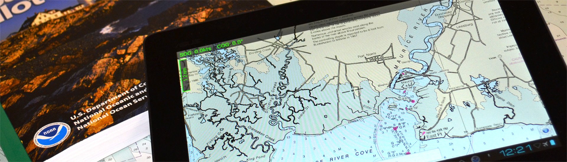
A safe boating experience cannot be imagined without nautical maps. Though conventional paper marine maps are still used on every boat, new technologically-advanced electronic charts have made the entire map reading and course planning routine much easier. So what is electronic cartography? The definition is pretty straightforward - electronic charts are digital versions of the most dependable government-issued paper charts and maps crated to simplify your navigation.
The data that is used by electronic charts comes from a number of government sources including NOAA, Canadian Hydrographics, and many others. Electronic charts give mariners greater possibilities on the water, providing you with innovative object-oriented cartography. Normally the electronic charts are displayed on chartplotters, multifunction displays (smartphones) or personal computers. Chartplotters, that are typically waterproof, are usually opted for when you own smaller 40’-50’ boats, while tablets and smartphones are well-suited for larger sail and power boats. PCs are usually used on large vessels and commercial boats.
Electronic charts are available in a number of formats: dynamic raster scanned charts (Maptech) that are basically direct video images of paper charts. They are precise and reliable versions of conventional paper charts. Vector charts (Garmin, Navionics, C-Map) typically take less memory as they have the information transformed into coordinates in a data file. Vector charts are “object oriented”, so when a cursor is positioned over icons, numerals, words or other features, additional windows with detailed descriptions will pop up. New generation 3D maps with high-definition relief will provide you with improved underwater view.
Electronic charts for chartplotters are usually available on small microSD memory cards that can be inserted into a GPS unit. In their turn, smartphone and PC charts are downloadable. While the paper maps show signs of heavy use, over time signaling you to get a newer version, the electronic chart will look brand new, but may pose danger when outdated. Thus, your electronic maps should be regularly updated and kept current to provide greater level of protection against marine hazards. Either used for recreational and commercial boating or fishing, interactive electronic charts will help you make the most of your boating experience.