Maptech Marine Navigation Charts

-
 Maptech®Block Island to Nantucket V5 Waterproof Chart (WPC019)Block Island to Nantucket V5 Waterproof Chart by Maptech®. 5-th Edition. Block Island and Point Judith, RI to Nantucket, MA. Featuring waypoints for major buoys, courses and distances, 63 wreck sites, and ramp locations and information....User-Friendly, Flip-Fold FormatKey Symbols and Finding Your Way Tips$23.73
 -
 Maptech®Chesapeake Bay to Florida V5 Guide (CGCBF-05)Chesapeake Bay to Florida V5 Guide by Maptech®. 5-th Edition. Cape May and Delaware Bay through the Chesapeake and Intracoastal Waterway, and offshore to the St. Johns River in northern Florida. Packed with detailed listings for...Engineered to high standardsHigh-grade design delivers extended lifespan$31.58
 -
 Maptech®Chesapeake and Delaware Bays V14 Chart Kit (R04-14)Chesapeake and Delaware Bays V14 Chart Kit by Maptech®. Region 4, 14-th Edition. Completely updated. Coastal and offshore coverage. Full-color charts, GPS waypoints, courses and distances, Yeoman points, and color aerial photos. Save...Expertly crafted from premium materialsDesigned to match rigorous quality standards$163.39
 -
 Maptech®Delaware Bay and the C-D Canal V2 Waterproof Chart (WPC047)Delaware Bay and the C-D Canal V2 Waterproof Chart by Maptech®. 2-nd Edition. Cape May, NJ to Wilmington, DE and Elk River, MD. Featuring GPS Waypoints, courses and distances, and fishing and wreck sites. 24" x 36", scale 1:108,000 with...User-Friendly, Flip-Fold FormatKey Symbols and Finding Your Way Tips$17.53
 -
 Maptech®Little Egg Harbor NJ to Cape May NJ V2 Waterproof Chart (WPC035)Little Egg Harbor NJ to Cape May NJ V2 Waterproof Chart by Maptech®. 2-nd Edition. Beach Haven, Little Egg, Brigantine, Absecon, Great Egg Corson, Townsends, Hereford and Cape May inlets. Featuring GPS Waypoints, courses and distances,...User-Friendly, Flip-Fold FormatKey Symbols and Finding Your Way Tips$28.98
 -
 Maptech®Long Island Sound to Cape May V15 Guide (CGLIS-15)Long Island Sound to Cape May V15 Guide by Maptech®. 15-th Edition. New York Harbor to Block Island, Long Island's South Shore, the Hudson River, and New Jersey's coast from Raritan Bay to Cape May. Packed with detailed listings for...Engineered to high standardsHigh-grade design delivers extended lifespan$34.57
 -
 Maptech®Lower Chesapeake Bay V3 Waterproof Chart (WPC026)Lower Chesapeake Bay V3 Waterproof Chart by Maptech®. 3-rd Edition. Smith Point to Chesapeake Approaches. Featuring waypoints for major buoys, courses and distances, and ramp locations and information. Great planning chart. 24" x 36",...User-Friendly, Flip-Fold FormatKey Symbols and Finding Your Way Tips$28.98
 -
 Maptech®New York to Nantucket and to Cape May New Jersey V17 Chart Kit (R03-17)New York to Nantucket and to Cape May New Jersey V17 Chart Kit by Maptech®. Region 3, 17th Edition. Maptech's ChartKits™ are full-color reproductions of NOAA charts bundled together in large cruising regions. ChartKits™ have been a...90 Chart PagesA Great Value You’ll save up to 90% compared to the cost of purchasing individual government charts$169.03
 -
 Maptech®Norfolk Va. to Florida and the Intracoastal Waterway V14 Chart Kit (R06-14)Norfolk Va. to Florida and the Intracoastal Waterway V14 Chart Kit by Maptech®. Region 6, 14th Edition. Norfolk, VA, to Fernandina Beach, FL, inside and outside. Includes ICW navigation advice and Bridge Table. Full-color charts, GPS...Expertly crafted from premium materialsDesigned to match rigorous quality standards$163.39
 -
 Maptech®Portsmouth Great Bay and Isles of Shoals V3 Waterproof Chart (WPC027-03)Portsmouth Great Bay and Isles of Shoals V3 Waterproof Chart by Maptech®. 3-rd Edition. Great Bay and Piscataqua River to Isles of Shoals. Featuring GPS Waypoints, courses and distances, ramp locations, state parks, and fishing areas....User-Friendly, Flip-Fold FormatKey Symbols and Finding Your Way Tips$17.02
 -
 Maptech®Sandy Hook, NJ-Atlantic City, NJ Chart (WPC034)Sandy Hook, NJ-Atlantic City, NJ Chart by Maptech®. This product is made of high-quality materials to serve you for years to come. Designed using state-of-the-art technology and with customers in mind. It will meet your needs and...Engineered to high standardsHigh-grade design delivers extended lifespan$28.98
 -
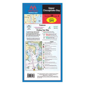
 Maptech®Upper Chesapeake Bay V4 Waterproof Chart (WPC025-04)Upper Chesapeake Bay V4 Waterproof Chart by Maptech®. 4-th Edition. C&D Canal to the Potomac River. Featuring waypoints for major buoys, courses and distances, and ramp locations and information. Great planning chart. 24 x 36, scale...User-Friendly, Flip-Fold FormatKey Symbols and Finding Your Way Tips$28.98
 -
 Maptech®WPB Long Island Sound V5 Chart Kit (WPB0325-05)WPB Long Island Sound V5 Chart Kit by Maptech®. 5-th Edition. Covers the entire Sound from Throgs Neck to Block Island and Point Judith. Easy-to-use format includes cruising facility information, GPS waypoints and magnetic tracks with...Expertly crafted from premium materialsDesigned to match rigorous quality standards$69.64
 -
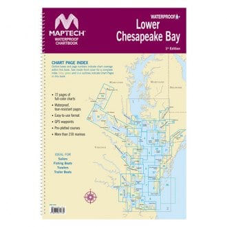
 Maptech®WPB Lower Chesapeake Bay Waterproof Chart Kit (WPB0440-01)WPB Lower Chesapeake Bay Waterproof Chart Kit by Maptech®. 1-st Edition. Solomons Island to Norfolk, Va. Offers full-color charts on waterproof, tear-resistant pages. Easy-to-use format includes GPS waypoints, pre-plotted courses and...Expertly crafted from premium materialsDesigned to match rigorous quality standards$90.12
 -
 Maptech®WPB South Shore Long Island V4 Chart Kit (WPB0340-04)WPB South Shore Long Island V4 Chart Kit by Maptech®. 4-th Edition. South Shore Long Island NY Harbor's Lower Bay to Montauk and Block Island. Easy-to-use format includes GPS waypoints, pre-plotted courses and more than 300 marinas. 27...Expertly crafted from premium materialsDesigned to match rigorous quality standards$69.64
 -
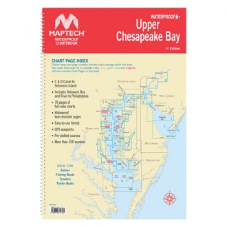
 Maptech®WPB Upper Chesapeake Bay Waterproof Chart Kit (WPB0430-01)WPB Upper Chesapeake Bay Waterproof Chart Kit by Maptech®. 1-st Edition. Covers C&D Canal to Solomons Island and includes Delaware Bay and River to Phildelphia. Offers full-color charts on waterproof, tear-resistant pages. Easy-to-use...Expertly crafted from premium materialsDesigned to match rigorous quality standards$90.12
 -
 Maptech®WPB New Jersey Coast. Raritan Bay to Cape May V3 Chart Kit (WPB0360-03)WPB New Jersey Coast. Raritan Bay to Cape May V3 Chart Kit by Maptech®. 3-rd Edition. New York Harbor to Cape May, NJ. Easy-to-use format includes GPS waypoints, pre-plotted courses and more than 380 marinas. 24 chart pages.Expertly crafted from premium materialsDesigned to match rigorous quality standards$69.64
A nautical chart is one of the oldest, simplest, and most effective tools that mariners have at their disposal for safe navigation when approaching the coast. They have been in circulation since the 2nd century when a sea map showed just a rough coastline. Modern charts are much more detailed and provide all the relevant hydrographic data including depths, obstacles, anchorages, tide predictions, and whatever makes navigation secure. Besides, charts help sailors to choose the most convenient route and, finally, they are required on most commercial vessels when crossing U.S. waters.
Maptech is a leading brand offering both paper and electronic navigation charts that stand out for meticulous accuracy. Whether you are heading on a fishing safari on a lake or sailing along the seacoast, you will find a reliable Maptech guide or chart to ease navigation and make your adventure more enjoyable. Chart books, training charts, and waterways maps are printed on waterproof and tear-resistant plastic pages. In our online store, we offer a wide choice of Maptech marine navigation charts and other useful tools for every sailing, cruising, or fishing trip.


