Navionics Marine Navigation Charts

-
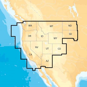
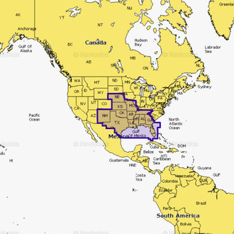
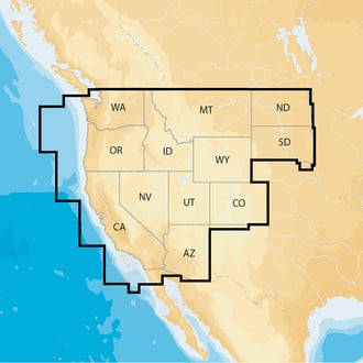
 Navionics®Navionics+ US West Electronic ChartNavionics+ US West Electronic Chart by Navionics®. Navionics+ Regions is a powerfull chart solution providing more regional marine and lakes content than any other product on the market! Get derailed Nautical Chart, SonarChart™ 1' HD...Marine and lake chartsOne foot contours$153.88 - $169.16
 - Navionics®Navionics+ Regions Canada & Alaska microSD Format Electronic Chart (MSD/NAV+CA)Navionics+ Regions Canada & Alaska microSD Format Electronic Chart by Navionics®. Navionics+ Regions is a powerfull chart solution providing more regional marine and lakes content than any other product on the market! Get derailed...Marine and lake chartsOne foot contours$160.49
- Navionics®Navionics+ US East microSD Format Electronic Chart (MSD/NAV+EA)Navionics+ US East microSD Format Electronic Chart by Navionics®. Navionics+ Regions is a powerfull chart solution providing more regional marine and lakes content than any other product on the market! Get derailed Nautical Chart,...Marine and lake chartsOne foot contours$149.00
- Navionics®Navionics+ US North microSD Format Electronic Chart (MSD/NAV+NO)Navionics+ US North microSD Format Electronic Chart by Navionics®. Navionics+ Regions is a powerfull chart solution providing more regional marine and lakes content than any other product on the market! Get derailed Nautical Chart,...Marine and lake chartsOne foot contours$149.00
- Navionics®Navionics+ US South microSD Format Electronic Chart (MSD/NAV+SO)Navionics+ US South microSD Format Electronic Chart by Navionics®. Navionics+ Regions is a powerfull chart solution providing more regional marine and lakes content than any other product on the market! Get derailed Nautical Chart,...Marine and lake chartsOne foot contours$149.00
- Navionics®Navionics+ US West microSD Format Electronic Chart (MSD/NAV+WE)Navionics+ US West microSD Format Electronic Chart (MSD/NAV+WE) by Navionics®. Navionics+ Regions is a powerfull chart solution providing more regional marine and lakes content than any other product on the market! Get derailed Nautical...Marine and lake chartsOne foot contours$153.88
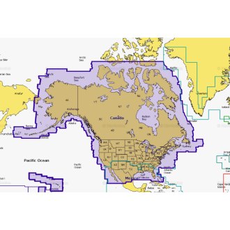
- Navionics®Navionics+ US and Canada microSD Format Electronic Chart (MSD/NAV+NI)Navionics+ US and Canada microSD Format Electronic Chart by Navionics®. All-in-one max detailed cartography for marine and lakes makes Navionics+ the perfect choice for cruising, fishing and sailing. Get the most accurate navigational...Plotter Sync allows Raymarine, Lowrance, Simrad and B&G plotter owners to transfer routes and markers, update charts and more!Boat Safer. Fish Smarter. Change the way you view Navionics charts and focus on the details that matter most to you$179.00
- Navionics®Platinum+ Puget Sound microSD Format Electronic Chart (MSD/638P+)Platinum+ Puget Sound microSD Format Electronic Chart by Navionics®. Head out with confidence! All the same marine and lakes content and advanced features found in Navionics+ are augmented with 3D View, satellite overlay and panoramic...The most advanced technology and best imaging available in multi-dimensional chartsImproved 3D view with enchanced bottom contour profiles and high-resolution photo overlay$259.08
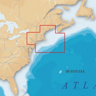
- Navionics®Platinum+ US North-East and Canyons microSD Format Electronic Chart (MSD/904P+)Platinum+ US North-East and Canyons microSD Format Electronic Chart by Navionics®. Head out with confidence! All the same marine and lakes content and advanced features found in Navionics+ are augmented with 3D View, satellite overlay...The most advanced technology and best imaging available in multi-dimensional chartsImproved 3D view with enchanced bottom contour profiles and high-resolution photo overlay$299.91
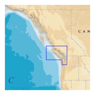
- Navionics®Platinum+ Vancouver Island microSD Format Electronic Chart (MSD913PPLUS)Platinum+ Vancouver Island microSD Format Electronic Chart by Navionics®. Head out with confidence! All the same marine and lakes content and advanced features found in Navionics+ are augmented with 3D View, satellite overlay and...The most advanced technology and best imaging available in multi-dimensional chartsImproved 3D view with enchanced bottom contour profiles and high-resolution photo overlay$229.21
- Navionics®Navionics+ Chile, Argentina & Easter Island microSD Format Electronic Chart (010-C1365-30)Navionics+ Chile, Argentina & Easter Island microSD Format Electronic Chart by Navionics®. Coastal coverage of South America from Arica, Chile to Rio Grande, Brazil. Coverage includes Easter Island, Cape Horn, the Falkland Islands/Islas...Marine and lake chartsOne foot contours$234.59
- Navionics®Navionics+ Mexico, Caribbean to Brazil microSD Format Electronic Chart (010-C1364-30)Navionics+ Mexico, Caribbean to Brazil microSD Format Electronic Chart by Navionics®. Coastal coverage of Mexico, Central America and Brazil. Coverage includes the US Gulf Coast and the eastern US coast to Savannah, GA; Bermuda; the...Marine and lake chartsOne foot contours$199.09
- Navionics®Platinum+ Chile, Argentina & Easter Island microSD Format Electronic Chart (010-C1365-40)Platinum+ Chile, Argentina & Easter Island microSD Format Electronic Chart by Navionics®. Coastal coverage of South America from Arica, Chile to Rio Grande, Brazil. Coverage includes Easter Island, Cape Horn, the Falkland Islands/Islas...The most advanced technology and best imaging available in multi-dimensional chartsImproved 3D view with enchanced bottom contour profiles and high-resolution photo overlay$453.85
- Navionics®Platinum+ Mexico, Caribbean to Brazil microSD Format Electronic Chart (010-C1364-40)Platinum+ Mexico, Caribbean to Brazil microSD Format Electronic Chart by Navionics®. Coastal coverage of Mexico, Central America and Brazil. Coverage includes the US Gulf Coast and the eastern US coast to Savannah, GA; Bermuda; the...The most advanced technology and best imaging available in multi-dimensional chartsImproved 3D view with enchanced bottom contour profiles and high-resolution photo overlay$453.85
- Navionics®HotMaps Platinum Lake Maps Canada microSD Format Electronic Chart (MSD/HMPT-C6)HotMaps Platinum Lake Maps Canada microSD Format Electronic Chart by Navionics®. The most comprehensive lake charts! Advanced features help you quickly target the best spots and catch mone fish! Check out the detailed Naulical Chart...Lake ChartsOne foot contours$206.99
- Navionics®HotMaps Platinum Lake Maps East microSD Format Electronic Chart (MSD/HMPT-E6)HotMaps Platinum Lake Maps East microSD Format Electronic Chart by Navionics®. The most comprehensive lake charts! Advanced features help you quickly target the best spots and catch mone fish! Check out the detailed Naulical Chart plus...Lake ChartsOne foot contours$249.48
- Navionics®HotMaps Platinum Lake Maps North microSD Format Electronic Chart (MSD/HMPT-N6)HotMaps Platinum Lake Maps North microSD Format Electronic Chart by Navionics®. The most comprehensive lake charts! Advanced features help you quickly target the best spots and catch mone fish! Check out the detailed Naulical Chart plus...Lake ChartsOne foot contours$213.66
- Navionics®Navionics Updates North America microSD Format Electronic Chart (MSD/NAVU-NI)Navionics Updates North America microSD Format Electronic Chart by Navionics®. Simply use your compatible card from Navionics, C-MAP, Fishing Hot Spots, Garmin, LakeMaster, Lowrance, Magellan and TrakMaps to activate Navionics Updates....Marine and lake chartsOne foot contours$99.00
- Navionics®Navionics+ US West CF Format Electronic Chart (CF/NAV+WE)Navionics+ US West CF Format Electronic Chart (CF/NAV+WE) by Navionics®. Navionics+ Regions is a powerfull chart solution providing more regional marine and lakes content than any other product on the market! Get derailed Nautical...Marine and lake chartsOne foot contours$169.16
- Navionics®Platinum+ Caribbean microSD Format Electronic Chart (MSD/908P-2)Platinum+ Caribbean microSD Format Electronic Chart by Navionics®. Head out with confidence! All the same marine and lakes content and advanced features found in Navionics+ are augmented with 3D View, satellite overlay and panoramic...The most advanced technology and best imaging available in multi-dimensional chartsImproved 3D view with enchanced bottom contour profiles and high-resolution photo overlay$413.10
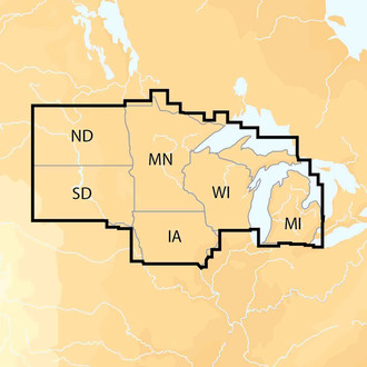
- Navionics®Platinum+ East Great Lakes microSD Format Electronic Chart (MSD/901P+)Platinum+ East Great Lakes microSD Format Electronic Chart by Navionics®. Head out with confidence! All the same marine and lakes content and advanced features found in Navionics+ are augmented with 3D View, satellite overlay and...The most advanced technology and best imaging available in multi-dimensional chartsImproved 3D view with enchanced bottom contour profiles and high-resolution photo overlay$412.07
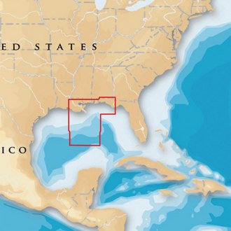
- Navionics®Platinum+ Gulf of Mexico Central microSD Format Electronic Chart (MSD/651P+)Platinum+ Gulf of Mexico Central microSD Format Electronic Chart by Navionics®. Head out with confidence! All the same marine and lakes content and advanced features found in Navionics+ are augmented with 3D View, satellite overlay and...The most advanced technology and best imaging available in multi-dimensional chartsImproved 3D view with enchanced bottom contour profiles and high-resolution photo overlay$213.13
- Navionics®Platinum+ Gulf of Mexico microSD Format Electronic Chart (MSD/907P+)Platinum+ Gulf of Mexico microSD Format Electronic Chart by Navionics®. Head out with confidence! All the same marine and lakes content and advanced features found in Navionics+ are augmented with 3D View, satellite overlay and...The most advanced technology and best imaging available in multi-dimensional chartsImproved 3D view with enchanced bottom contour profiles and high-resolution photo overlay$466.03
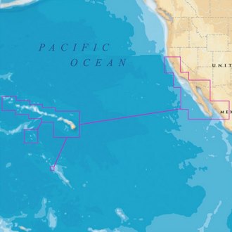
- Navionics®Platinum+ Hawaii, California South to Baja microSD Format Electronic Chart (MSD/644P+)Platinum+ Hawaii, California South to Baja microSD Format Electronic Chart by Navionics®. Head out with confidence! All the same marine and lakes content and advanced features found in Navionics+ are augmented with 3D View, satellite...The most advanced technology and best imaging available in multi-dimensional chartsImproved 3D view with enchanced bottom contour profiles and high-resolution photo overlay$220.05
- Navionics®Platinum+ Mid Atlantic and Canyons microSD Format Electronic Chart (MSD/905P+)Platinum+ Mid Atlantic and Canyons microSD Format Electronic Chart by Navionics®. Head out with confidence! All the same marine and lakes content and advanced features found in Navionics+ are augmented with 3D View, satellite overlay...The most advanced technology and best imaging available in multi-dimensional chartsImproved 3D view with enchanced bottom contour profiles and high-resolution photo overlay$425.45
- Navionics®Platinum+ North Carolina microSD Format Electronic Chart (MSD/645P+)Platinum+ North Carolina microSD Format Electronic Chart by Navionics®. Head out with confidence! All the same marine and lakes content and advanced features found in Navionics+ are augmented with 3D View, satellite overlay and...The most advanced technology and best imaging available in multi-dimensional chartsImproved 3D view with enchanced bottom contour profiles and high-resolution photo overlay$241.05
- Navionics®Platinum+ Nova Scotia and Newfoundland microSD Format Electronic Chart (MSD/903P-2)Platinum+ Nova Scotia and Newfoundland microSD Format Electronic Chart by Navionics®. Head out with confidence! All the same marine and lakes content and advanced features found in Navionics+ are augmented with 3D View, satellite...The most advanced technology and best imaging available in multi-dimensional chartsImproved 3D view with enchanced bottom contour profiles and high-resolution photo overlay$445.04
- Navionics®Platinum+ Nova Scotia and St. Lawrance River microSD Format Electronic Chart (MSD/902P-2)Platinum+ Nova Scotia and St. Lawrance River microSD Format Electronic Chart by Navionics®. Head out with confidence! All the same marine and lakes content and advanced features found in Navionics+ are augmented with 3D View, satellite...The most advanced technology and best imaging available in multi-dimensional chartsImproved 3D view with enchanced bottom contour profiles and high-resolution photo overlay$412.90
- Navionics®Platinum+ Oregon and California microSD Format Electronic Chart (MSD/643P+)Platinum+ Oregon and California microSD Format Electronic Chart by Navionics®. Head out with confidence! All the same marine and lakes content and advanced features found in Navionics+ are augmented with 3D View, satellite overlay and...The most advanced technology and best imaging available in multi-dimensional chartsImproved 3D view with enchanced bottom contour profiles and high-resolution photo overlay$220.05
- Navionics®Platinum+ South Carolina and North Florida microSD Format Electronic Chart (MSD/642P+)Platinum+ South Carolina and North Florida microSD Format Electronic Chart by Navionics®. Head out with confidence! All the same marine and lakes content and advanced features found in Navionics+ are augmented with 3D View, satellite...The most advanced technology and best imaging available in multi-dimensional chartsImproved 3D view with enchanced bottom contour profiles and high-resolution photo overlay$220.05


Navionics has grown from a two-man show started in 1984 to a diverse team operating in all continents and countless countries, that puts real pride and passion in developing products for safer and easier navigation. Today Navionics employs over 500 enthusiastic persons, mainly located in USA, Italy and India, but with sales and service all over the world.
Navionics has the world’s largest database of marine and lake charts, covering the salt waters of the entire planet as well as tens of thousands of lakes and rivers. Many of these charts have been developed by way of Navionics’ proprietary surveys done both in the field and with remote sensing such as satellite imagery and airborne laser scanners.
The engineering team, a unique mix of long experienced people as well young brains still in school, is responsible for developing technologies that are constantly a few years ahead of the competition, but at the same time are easy and enjoyable to use by any outdoors person.