Marine Charting & Cartography
-
 C-MAP®Max Wide Gulf of Maine Bathymetric Electronic ChartMax Wide Gulf of Maine Bathymetric Electronic Chart by C-MAP®. C-MAP MAX electronic charts have been a worldwide standard for years, providing cruisers, sailors and fishermen with the accurate, up-to-date chart data they need to enjoy...Updated twice annually to provide all the latest detail and informationCompatible with dozens of chartplotters from top manufacturers$308.28
 - C-MAP®Max Wide Gulf of Mexico Bathymetric Electronic ChartMax Wide Gulf of Mexico Bathymetric Electronic Chart by C-MAP®. C-MAP MAX electronic charts have been a worldwide standard for years, providing cruisers, sailors and fishermen with the accurate, up-to-date chart data they need to enjoy...Updated twice annually to provide all the latest detail and informationCompatible with dozens of chartplotters from top manufacturers$301.32 - $308.28
- C-MAP®Max Wide the Great Lakes, North East Coast and Approaches Electronic ChartMax Wide the Great Lakes, North East Coast and Approaches Electronic Chart by C-MAP®. C-MAP MAX electronic charts have been a worldwide standard for years, providing cruisers, sailors and fishermen with the accurate, up-to-date chart...Updated twice annually to provide all the latest detail and informationCompatible with dozens of chartplotters from top manufacturers$301.32 - $308.28
- Davis Instruments®Mark 15 SextantMark 15 Sextant by Davis Instruments®. This model has many great features including seven large sunshades, a 3 mm x 27 mm star scope, and easy-to-read micrometer drum vernier scale that reads to 2/10 of a minute. The Mark 15 has a 7?...Engineered to high standardsHigh-grade design delivers extended lifespan$288.21
- Davis Instruments®Mark 25 SextantMark 25 Sextant by Davis Instruments®. The top of the line Davis plastic sextant, the Mark 25 features our Beam Converger™ mirror, sometimes referred to as a “full horizon mirror”. A special coating is applied to high quality...Engineered to high standardsHigh-grade design delivers extended lifespan$331.45
- Davis Instruments®Mark 3 SextantMark 3 Sextant by Davis Instruments®. Sometimes referred to as a “lifeboat” sextant, the Mark 3 is an inexpensive training sextant. Yet this model has taken sailors around the world, too! It is full-sized and has sunshades, but no...Engineered to high standardsHigh-grade design delivers extended lifespan$86.83
- Nobeltec®TZ Navigator Software UpgradeTZ Navigator Software Upgrade by Nobeltec®. This product is made of high-quality materials to serve you for years to come. Designed using state-of-the-art technology and with customers in mind, this product by Nobeltec® will last a...Improvements in the find similar areas feature to provide more precise resultsPerfect to enhance your comfort and safety$143.00 - $190.00
- Nobeltec®TZ Professional SoftwareTZ Professional Software by Nobeltec®. This product is made of high-quality materials to serve you for years to come. Designed using state-of-the-art technology and with customers in mind, this product by Nobeltec® will last a...Improvements in the find similar areas feature to provide more precise resultsPerfect to enhance your comfort and safety$950.00 - $1,457.64
- Nobeltec®TZ Professional Software UpgradeTZ Professional Software Upgrade by Nobeltec®. This product is made of high-quality materials to serve you for years to come. Designed using state-of-the-art technology and with customers in mind, this product by Nobeltec® will last a...Improvements in the find similar areas feature to provide more precise resultsPerfect to enhance your comfort and safety$950.00 - $1,425.00
- C-MAP®Reveal Canada Lakes microSD Format Bathymetric Electronic Chart (M-NA-Y216-MS)Reveal Canada Lakes microSD Format Bathymetric Electronic Chart by C-MAP®. Perfect for fishing and diving enthusiasts, C-MAP Reveal charts deliver ultra, high-resolution images of structure, wrecks, isolated reefs and ledges on the sea...High-definition C-MAP Reveal layer on selected areasReduces search time with immediate high-definition display of bottom structure, wrecks, isolated reefs and ledges$183.49
- C-MAP®Reveal Coastal Canada North and East microSD Format Bathymetric Electronic Chart (M-NA-Y209-MS)Reveal Coastal Canada North and East microSD Format Bathymetric Electronic Chart by C-MAP®. Perfect for fishing and diving enthusiasts, C-MAP Reveal charts deliver ultra, high-resolution images of structure, wrecks, isolated reefs and...High-definition C-MAP Reveal layer on selected areasReduces search time with immediate high-definition display of bottom structure, wrecks, isolated reefs and ledges$269.89
- C-MAP®Reveal Inland West US Lakes microSD Format Bathymetric Electronic Chart (M-NA-Y211-MS)Reveal Inland West US Lakes microSD Format Bathymetric Electronic Chart by C-MAP®. Perfect for fishing and diving enthusiasts, C-MAP Reveal charts deliver ultra, high-resolution images of structure, wrecks, isolated reefs and ledges on...High-definition C-MAP Reveal layer on selected areasReduces search time with immediate high-definition display of bottom structure, wrecks, isolated reefs and ledges$183.49
- C-MAP®Reveal St. Lucie Inlet to New Orleans microSD Format Bathymetric Electronic Chart (M-NA-Y-644-MS)Reveal St. Lucie Inlet to New Orleans microSD Format Bathymetric Electronic Chart by C-MAP®. Perfect for fishing and diving enthusiasts, C-MAP Reveal charts deliver ultra, high-resolution images of structure, wrecks, isolated reefs and...High-definition C-MAP Reveal layer on selected areasReduces search time with immediate high-definition display of bottom structure, wrecks, isolated reefs and ledges$324.34
- C-MAP®4D Alaska microSD Format Electronic Chart (M-NA-D028-MS)4D Alaska microSD Format Electronic Chart by C-MAP®. Coverage of the southern Alaska coast from Dixon Entrance up and over to Kodiak Island. Includes all of the Aleutian Islands out to Attu Island, Bristol Bay, and the North Slope over...Full Featured Vector Charts: Provides a wealth of chart detail with the versatility to customize data layers and how they are viewedDynamic Raster: Traditional "paper chart" look with unique ability to access information on buoys, lights and other details$366.12
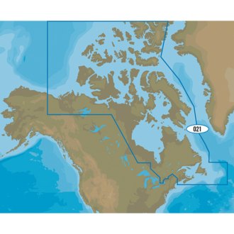
- C-MAP®4D Canada North and East microSD Format Electronic Chart (M-NA-D021-MS)4D Canada North and East microSD Format Electronic Chart by C-MAP®. Coverage of the Arctic and Atlantic coasts of Canada including Hudson Bay, Newfoundland, the Gulf of St. Lawrence, Nova Scotia and the Bay of Fundy. Also includes...Full Featured Vector Charts: Provides a wealth of chart detail with the versatility to customize data layers and how they are viewedDynamic Raster: Traditional "paper chart" look with unique ability to access information on buoys, lights and other details$366.12
- C-MAP®4D Canada West and Puget Sound microSD Format Electronic Chart (M-NA-D025-MS)4D Canada West and Puget Sound microSD Format Electronic Chart by C-MAP®. Coverage of British Columbia, Puget Sound and the San Juan Islands. Full coverage of Vancouver Island and the Queen Charlotte Islands is also included. Full...Full Featured Vector Charts: Provides a wealth of chart detail with the versatility to customize data layers and how they are viewedDynamic Raster: Traditional "paper chart" look with unique ability to access information on buoys, lights and other details$366.12
- C-MAP®4D Central America and the Caribbean microSD Format Electronic Chart (M-NA-D065-MS)4D Central America and the Caribbean microSD Format Electronic Chart by C-MAP®. C-MAP 4D is the latest evolution of electronic charting technology, combining award-winning vector chart data with exclusive Dynamic Raster Charts and the...Full Featured Vector Charts: Provides a wealth of chart detail with the versatility to customize data layers and how they are viewedDynamic Raster: Traditional "paper chart" look with unique ability to access information on buoys, lights and other details$366.12
- C-MAP®4D Chesapeake Bay to Cuba microSD Format Electronic Chart (M-NA-D063-MS)4D Chesapeake Bay to Cuba microSD Format Electronic Chart by C-MAP®. C-MAP 4D is the latest evolution of electronic charting technology, combining award-winning vector chart data with exclusive Dynamic Raster Charts and the ability to...Full Featured Vector Charts: Provides a wealth of chart detail with the versatility to customize data layers and how they are viewedDynamic Raster: Traditional "paper chart" look with unique ability to access information on buoys, lights and other details$366.12
- C-MAP®4D Gulf of Mexico microSD Format Electronic Chart (M-NA-D064-MS)4D Gulf of Mexico microSD Format Electronic Chart by C-MAP®. With vector and raster charts, satellite imagery, hi-res bathy data, tides & currents, port info, and can be viewed in 2D or 3D. C-MAP 4D is the latest evolution of electronic...Full Featured Vector Charts: Provides a wealth of chart detail with the versatility to customize data layers and how they are viewedDynamic Raster: Traditional "paper chart" look with unique ability to access information on buoys, lights and other details$366.12
- C-MAP®4D Gulf of Mexico to the Caribbean microSD Format Electronic Chart (M-NA-D033-MS)4D Gulf of Mexico to the Caribbean microSD Format Electronic Chart by C-MAP®. C-MAP 4D is the latest evolution of electronic charting technology, combining award-winning vector chart data with exclusive Dynamic Raster Charts and the...Full Featured Vector Charts: Provides a wealth of chart detail with the versatility to customize data layers and how they are viewedDynamic Raster: Traditional "paper chart" look with unique ability to access information on buoys, lights and other details$193.32
- C-MAP®4D Lakes Alaskan Lakes microSD Format Electronic Chart (M-NA-D029-MS)4D Lakes Alaskan Lakes microSD Format Electronic Chart by C-MAP®. C-MAP 4D is the latest evolution of electronic charting technology, combining award-winning vector chart data with exclusive Dynamic Raster Charts and the ability to view...Full Featured Vector Charts: Provides a wealth of chart detail with the versatility to customize data layers and how they are viewedDynamic Raster: Traditional "paper chart" look with unique ability to access information on buoys, lights and other details$106.92
- C-MAP®4D Lakes Canadian Lakes microSD Format Electronic Chart (M-NA-D048-MS)4D Lakes Canadian Lakes microSD Format Electronic Chart by C-MAP®. C-MAP 4D is the latest evolution of electronic charting technology, combining award-winning vector chart data with exclusive Dynamic Raster Charts and the ability to...Full Featured Vector Charts: Provides a wealth of chart detail with the versatility to customize data layers and how they are viewedDynamic Raster: Traditional "paper chart" look with unique ability to access information on buoys, lights and other details$106.92
- C-MAP®4D Lakes North East US Lakes microSD Format Electronic Chart (M-NA-D073-MS)4D Lakes North East US Lakes microSD Format Electronic Chart by C-MAP®. Coverage Area: Lakes and major rivers of North East region of USA, including states of: Maine, Vermont, New York, New Jersey, New Hampshire, Massachuesetts,...Full Featured Vector Charts: Provides a wealth of chart detail with the versatility to customize data layers and how they are viewedDynamic Raster: Traditional "paper chart" look with unique ability to access information on buoys, lights and other details$193.32
- C-MAP®4D Lakes South Central US Lakes microSD Format Electronic Chart (M-NA-D075-MS)4D Lakes South Central US Lakes microSD Format Electronic Chart by C-MAP®. Coverage Area: USA lakes and rivers of the south-central US region, including but not limited to Gulf coast Key West to approaches of Mississippi River;...Full Featured Vector Charts: Provides a wealth of chart detail with the versatility to customize data layers and how they are viewedDynamic Raster: Traditional "paper chart" look with unique ability to access information on buoys, lights and other details$193.32
- C-MAP®4D Lakes South East US Lakes microSD Format Electronic Chart (M-NA-D074-MS)4D Lakes South East US Lakes microSD Format Electronic Chart by C-MAP®. Coverage Area: Lakes and major rivers of the South East area of the USA in the states of: Florida, Georgia, Alabama, Tennessee, South Carolina, North Carolina....Full Featured Vector Charts: Provides a wealth of chart detail with the versatility to customize data layers and how they are viewedDynamic Raster: Traditional "paper chart" look with unique ability to access information on buoys, lights and other details$193.32
- C-MAP®4D Lakes West US Lakes microSD Format Electronic Chart (M-NA-D071-MS)4D Lakes West US Lakes microSD Format Electronic Chart by C-MAP®. Coverage Area: USA lakes and rivers of the west US region, including but not limited to: Washington, Oregon, California, Nevada, Idaho, Utah, Arizona, New Mexico,...Full Featured Vector Charts: Provides a wealth of chart detail with the versatility to customize data layers and how they are viewedDynamic Raster: Traditional "paper chart" look with unique ability to access information on buoys, lights and other details$193.32
- C-MAP®4D Lakes the Great Lakes & St. Lawrence Seaway microSD Format Electronic Chart (M-NA-D061-MS)4D Lakes the Great Lakes & St. Lawrence Seaway microSD Format Electronic Chart by C-MAP®. C-MAP 4D is the latest evolution of electronic charting technology, combining award-winning vector chart data with exclusive Dynamic Raster Charts...Full Featured Vector Charts: Provides a wealth of chart detail with the versatility to customize data layers and how they are viewedDynamic Raster: Traditional "paper chart" look with unique ability to access information on buoys, lights and other details$366.12
- C-MAP®4D Local Block Island to Norfolk microSD Format Electronic Chart (M-NA-D941-MS)4D Local Block Island to Norfolk microSD Format Electronic Chart by C-MAP®. C-MAP 4D is the latest evolution of electronic charting technology, combining award-winning vector chart data with exclusive Dynamic Raster Charts and the...Full Featured Vector Charts: Provides a wealth of chart detail with the versatility to customize data layers and how they are viewedDynamic Raster: Traditional "paper chart" look with unique ability to access information on buoys, lights and other details$214.92
- C-MAP®4D Local Bristol Bay to Amukta Pass microSD Format Electronic Chart (M-NA-D961-MS)4D Local Bristol Bay to Amukta Pass microSD Format Electronic Chart by C-MAP®. C-MAP 4D is the latest evolution of electronic charting technology, combining award-winning vector chart data with exclusive Dynamic Raster Charts and the...Full Featured Vector Charts: Provides a wealth of chart detail with the versatility to customize data layers and how they are viewedDynamic Raster: Traditional "paper chart" look with unique ability to access information on buoys, lights and other details$214.92
- C-MAP®4D Local Brownsville, TX to Coatzacoalcos, MX microSD Format Electronic Chart (M-NA-D946-MS)4D Local Brownsville, TX to Coatzacoalcos, MX microSD Format Electronic Chart by C-MAP®. C-MAP 4D is the latest evolution of electronic charting technology, combining award-winning vector chart data with exclusive Dynamic Raster Charts...Full Featured Vector Charts: Provides a wealth of chart detail with the versatility to customize data layers and how they are viewedDynamic Raster: Traditional "paper chart" look with unique ability to access information on buoys, lights and other details$214.92


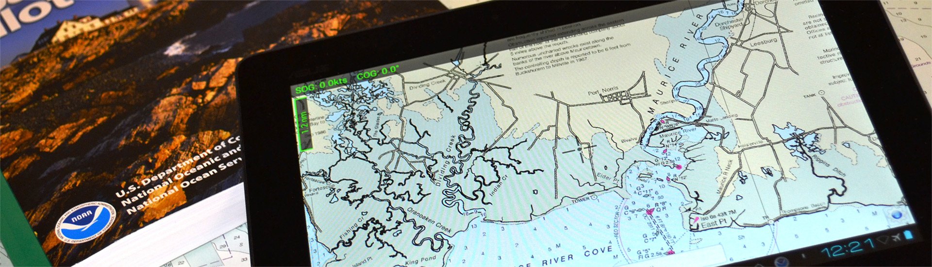
A safe boating experience cannot be imagined without nautical maps. Though conventional paper marine maps are still used on every boat, new technologically-advanced electronic charts have made the entire map reading and course planning routine much easier. So what is electronic cartography? The definition is pretty straightforward - electronic charts are digital versions of the most dependable government-issued paper charts and maps crated to simplify your navigation.
The data that is used by electronic charts comes from a number of government sources including NOAA, Canadian Hydrographics, and many others. Electronic charts give mariners greater possibilities on the water, providing you with innovative object-oriented cartography. Normally the electronic charts are displayed on chartplotters, multifunction displays (smartphones) or personal computers. Chartplotters, that are typically waterproof, are usually opted for when you own smaller 40’-50’ boats, while tablets and smartphones are well-suited for larger sail and power boats. PCs are usually used on large vessels and commercial boats.
Electronic charts are available in a number of formats: dynamic raster scanned charts (Maptech) that are basically direct video images of paper charts. They are precise and reliable versions of conventional paper charts. Vector charts (Garmin, Navionics, C-Map) typically take less memory as they have the information transformed into coordinates in a data file. Vector charts are “object oriented”, so when a cursor is positioned over icons, numerals, words or other features, additional windows with detailed descriptions will pop up. New generation 3D maps with high-definition relief will provide you with improved underwater view.
Electronic charts for chartplotters are usually available on small microSD memory cards that can be inserted into a GPS unit. In their turn, smartphone and PC charts are downloadable. While the paper maps show signs of heavy use, over time signaling you to get a newer version, the electronic chart will look brand new, but may pose danger when outdated. Thus, your electronic maps should be regularly updated and kept current to provide greater level of protection against marine hazards. Either used for recreational and commercial boating or fishing, interactive electronic charts will help you make the most of your boating experience.