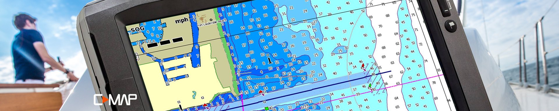
C-MAP Marine Electronic Charts
-
 C-MAP®Max Wide East Coast and the Bahamas Electronic ChartMax Wide East Coast and the Bahamas Electronic Chart by C-MAP®. C-MAP MAX electronic charts have been a worldwide standard for years, providing cruisers, sailors and fishermen with the accurate, up-to-date chart data they need to enjoy...Updated twice annually to provide all the latest detail and informationCompatible with dozens of chartplotters from top manufacturers$301.32 - $308.28
 - C-MAP®Max Wide Gulf Coast, the Great Lakes and Rivers Electronic ChartMax Wide Gulf Coast, the Great Lakes and Rivers Electronic Chart by C-MAP®. C-MAP MAX electronic charts have been a worldwide standard for years, providing cruisers, sailors and fishermen with the accurate, up-to-date chart data they...Updated twice annually to provide all the latest detail and informationCompatible with dozens of chartplotters from top manufacturers$301.32 - $308.28
- C-MAP®Max Wide Gulf of Maine Bathymetric Electronic ChartMax Wide Gulf of Maine Bathymetric Electronic Chart by C-MAP®. C-MAP MAX electronic charts have been a worldwide standard for years, providing cruisers, sailors and fishermen with the accurate, up-to-date chart data they need to enjoy...Updated twice annually to provide all the latest detail and informationCompatible with dozens of chartplotters from top manufacturers$308.28
- C-MAP®Max Wide Gulf of Mexico Bathymetric Electronic ChartMax Wide Gulf of Mexico Bathymetric Electronic Chart by C-MAP®. C-MAP MAX electronic charts have been a worldwide standard for years, providing cruisers, sailors and fishermen with the accurate, up-to-date chart data they need to enjoy...Updated twice annually to provide all the latest detail and informationCompatible with dozens of chartplotters from top manufacturers$301.32 - $308.28
- C-MAP®Max Wide the Great Lakes, North East Coast and Approaches Electronic ChartMax Wide the Great Lakes, North East Coast and Approaches Electronic Chart by C-MAP®. C-MAP MAX electronic charts have been a worldwide standard for years, providing cruisers, sailors and fishermen with the accurate, up-to-date chart...Updated twice annually to provide all the latest detail and informationCompatible with dozens of chartplotters from top manufacturers$301.32 - $308.28
- C-MAP®Reveal Canada Lakes microSD Format Bathymetric Electronic Chart (M-NA-Y216-MS)Reveal Canada Lakes microSD Format Bathymetric Electronic Chart by C-MAP®. Perfect for fishing and diving enthusiasts, C-MAP Reveal charts deliver ultra, high-resolution images of structure, wrecks, isolated reefs and ledges on the sea...High-definition C-MAP Reveal layer on selected areasReduces search time with immediate high-definition display of bottom structure, wrecks, isolated reefs and ledges$183.49
- C-MAP®Reveal Coastal Canada North and East microSD Format Bathymetric Electronic Chart (M-NA-Y209-MS)Reveal Coastal Canada North and East microSD Format Bathymetric Electronic Chart by C-MAP®. Perfect for fishing and diving enthusiasts, C-MAP Reveal charts deliver ultra, high-resolution images of structure, wrecks, isolated reefs and...High-definition C-MAP Reveal layer on selected areasReduces search time with immediate high-definition display of bottom structure, wrecks, isolated reefs and ledges$269.89
- C-MAP®Reveal Inland West US Lakes microSD Format Bathymetric Electronic Chart (M-NA-Y211-MS)Reveal Inland West US Lakes microSD Format Bathymetric Electronic Chart by C-MAP®. Perfect for fishing and diving enthusiasts, C-MAP Reveal charts deliver ultra, high-resolution images of structure, wrecks, isolated reefs and ledges on...High-definition C-MAP Reveal layer on selected areasReduces search time with immediate high-definition display of bottom structure, wrecks, isolated reefs and ledges$183.49
- C-MAP®Reveal St. Lucie Inlet to New Orleans microSD Format Bathymetric Electronic Chart (M-NA-Y-644-MS)Reveal St. Lucie Inlet to New Orleans microSD Format Bathymetric Electronic Chart by C-MAP®. Perfect for fishing and diving enthusiasts, C-MAP Reveal charts deliver ultra, high-resolution images of structure, wrecks, isolated reefs and...High-definition C-MAP Reveal layer on selected areasReduces search time with immediate high-definition display of bottom structure, wrecks, isolated reefs and ledges$324.34
- C-MAP®4D Alaska microSD Format Electronic Chart (M-NA-D028-MS)4D Alaska microSD Format Electronic Chart by C-MAP®. Coverage of the southern Alaska coast from Dixon Entrance up and over to Kodiak Island. Includes all of the Aleutian Islands out to Attu Island, Bristol Bay, and the North Slope over...Full Featured Vector Charts: Provides a wealth of chart detail with the versatility to customize data layers and how they are viewedDynamic Raster: Traditional "paper chart" look with unique ability to access information on buoys, lights and other details$366.12
- C-MAP®4D Canada North and East microSD Format Electronic Chart (M-NA-D021-MS)4D Canada North and East microSD Format Electronic Chart by C-MAP®. Coverage of the Arctic and Atlantic coasts of Canada including Hudson Bay, Newfoundland, the Gulf of St. Lawrence, Nova Scotia and the Bay of Fundy. Also includes...Full Featured Vector Charts: Provides a wealth of chart detail with the versatility to customize data layers and how they are viewedDynamic Raster: Traditional "paper chart" look with unique ability to access information on buoys, lights and other details$366.12
- C-MAP®4D Canada West and Puget Sound microSD Format Electronic Chart (M-NA-D025-MS)4D Canada West and Puget Sound microSD Format Electronic Chart by C-MAP®. Coverage of British Columbia, Puget Sound and the San Juan Islands. Full coverage of Vancouver Island and the Queen Charlotte Islands is also included. Full...Full Featured Vector Charts: Provides a wealth of chart detail with the versatility to customize data layers and how they are viewedDynamic Raster: Traditional "paper chart" look with unique ability to access information on buoys, lights and other details$366.12
- C-MAP®4D Central America and the Caribbean microSD Format Electronic Chart (M-NA-D065-MS)4D Central America and the Caribbean microSD Format Electronic Chart by C-MAP®. C-MAP 4D is the latest evolution of electronic charting technology, combining award-winning vector chart data with exclusive Dynamic Raster Charts and the...Full Featured Vector Charts: Provides a wealth of chart detail with the versatility to customize data layers and how they are viewedDynamic Raster: Traditional "paper chart" look with unique ability to access information on buoys, lights and other details$366.12
- C-MAP®4D Chesapeake Bay to Cuba microSD Format Electronic Chart (M-NA-D063-MS)4D Chesapeake Bay to Cuba microSD Format Electronic Chart by C-MAP®. C-MAP 4D is the latest evolution of electronic charting technology, combining award-winning vector chart data with exclusive Dynamic Raster Charts and the ability to...Full Featured Vector Charts: Provides a wealth of chart detail with the versatility to customize data layers and how they are viewedDynamic Raster: Traditional "paper chart" look with unique ability to access information on buoys, lights and other details$366.12
- C-MAP®4D Gulf of Mexico microSD Format Electronic Chart (M-NA-D064-MS)4D Gulf of Mexico microSD Format Electronic Chart by C-MAP®. With vector and raster charts, satellite imagery, hi-res bathy data, tides & currents, port info, and can be viewed in 2D or 3D. C-MAP 4D is the latest evolution of electronic...Full Featured Vector Charts: Provides a wealth of chart detail with the versatility to customize data layers and how they are viewedDynamic Raster: Traditional "paper chart" look with unique ability to access information on buoys, lights and other details$366.12
- C-MAP®4D Gulf of Mexico to the Caribbean microSD Format Electronic Chart (M-NA-D033-MS)4D Gulf of Mexico to the Caribbean microSD Format Electronic Chart by C-MAP®. C-MAP 4D is the latest evolution of electronic charting technology, combining award-winning vector chart data with exclusive Dynamic Raster Charts and the...Full Featured Vector Charts: Provides a wealth of chart detail with the versatility to customize data layers and how they are viewedDynamic Raster: Traditional "paper chart" look with unique ability to access information on buoys, lights and other details$193.32
- C-MAP®4D Lakes Alaskan Lakes microSD Format Electronic Chart (M-NA-D029-MS)4D Lakes Alaskan Lakes microSD Format Electronic Chart by C-MAP®. C-MAP 4D is the latest evolution of electronic charting technology, combining award-winning vector chart data with exclusive Dynamic Raster Charts and the ability to view...Full Featured Vector Charts: Provides a wealth of chart detail with the versatility to customize data layers and how they are viewedDynamic Raster: Traditional "paper chart" look with unique ability to access information on buoys, lights and other details$106.92
- C-MAP®4D Lakes Canadian Lakes microSD Format Electronic Chart (M-NA-D048-MS)4D Lakes Canadian Lakes microSD Format Electronic Chart by C-MAP®. C-MAP 4D is the latest evolution of electronic charting technology, combining award-winning vector chart data with exclusive Dynamic Raster Charts and the ability to...Full Featured Vector Charts: Provides a wealth of chart detail with the versatility to customize data layers and how they are viewedDynamic Raster: Traditional "paper chart" look with unique ability to access information on buoys, lights and other details$106.92
- C-MAP®4D Lakes North East US Lakes microSD Format Electronic Chart (M-NA-D073-MS)4D Lakes North East US Lakes microSD Format Electronic Chart by C-MAP®. Coverage Area: Lakes and major rivers of North East region of USA, including states of: Maine, Vermont, New York, New Jersey, New Hampshire, Massachuesetts,...Full Featured Vector Charts: Provides a wealth of chart detail with the versatility to customize data layers and how they are viewedDynamic Raster: Traditional "paper chart" look with unique ability to access information on buoys, lights and other details$193.32
- C-MAP®4D Lakes South Central US Lakes microSD Format Electronic Chart (M-NA-D075-MS)4D Lakes South Central US Lakes microSD Format Electronic Chart by C-MAP®. Coverage Area: USA lakes and rivers of the south-central US region, including but not limited to Gulf coast Key West to approaches of Mississippi River;...Full Featured Vector Charts: Provides a wealth of chart detail with the versatility to customize data layers and how they are viewedDynamic Raster: Traditional "paper chart" look with unique ability to access information on buoys, lights and other details$193.32
- C-MAP®4D Lakes South East US Lakes microSD Format Electronic Chart (M-NA-D074-MS)4D Lakes South East US Lakes microSD Format Electronic Chart by C-MAP®. Coverage Area: Lakes and major rivers of the South East area of the USA in the states of: Florida, Georgia, Alabama, Tennessee, South Carolina, North Carolina....Full Featured Vector Charts: Provides a wealth of chart detail with the versatility to customize data layers and how they are viewedDynamic Raster: Traditional "paper chart" look with unique ability to access information on buoys, lights and other details$193.32
- C-MAP®4D Lakes West US Lakes microSD Format Electronic Chart (M-NA-D071-MS)4D Lakes West US Lakes microSD Format Electronic Chart by C-MAP®. Coverage Area: USA lakes and rivers of the west US region, including but not limited to: Washington, Oregon, California, Nevada, Idaho, Utah, Arizona, New Mexico,...Full Featured Vector Charts: Provides a wealth of chart detail with the versatility to customize data layers and how they are viewedDynamic Raster: Traditional "paper chart" look with unique ability to access information on buoys, lights and other details$193.32
- C-MAP®4D Lakes the Great Lakes & St. Lawrence Seaway microSD Format Electronic Chart (M-NA-D061-MS)4D Lakes the Great Lakes & St. Lawrence Seaway microSD Format Electronic Chart by C-MAP®. C-MAP 4D is the latest evolution of electronic charting technology, combining award-winning vector chart data with exclusive Dynamic Raster Charts...Full Featured Vector Charts: Provides a wealth of chart detail with the versatility to customize data layers and how they are viewedDynamic Raster: Traditional "paper chart" look with unique ability to access information on buoys, lights and other details$366.12
- C-MAP®4D Local Block Island to Norfolk microSD Format Electronic Chart (M-NA-D941-MS)4D Local Block Island to Norfolk microSD Format Electronic Chart by C-MAP®. C-MAP 4D is the latest evolution of electronic charting technology, combining award-winning vector chart data with exclusive Dynamic Raster Charts and the...Full Featured Vector Charts: Provides a wealth of chart detail with the versatility to customize data layers and how they are viewedDynamic Raster: Traditional "paper chart" look with unique ability to access information on buoys, lights and other details$214.92
- C-MAP®4D Local Bristol Bay to Amukta Pass microSD Format Electronic Chart (M-NA-D961-MS)4D Local Bristol Bay to Amukta Pass microSD Format Electronic Chart by C-MAP®. C-MAP 4D is the latest evolution of electronic charting technology, combining award-winning vector chart data with exclusive Dynamic Raster Charts and the...Full Featured Vector Charts: Provides a wealth of chart detail with the versatility to customize data layers and how they are viewedDynamic Raster: Traditional "paper chart" look with unique ability to access information on buoys, lights and other details$214.92
- C-MAP®4D Local Brownsville, TX to Coatzacoalcos, MX microSD Format Electronic Chart (M-NA-D946-MS)4D Local Brownsville, TX to Coatzacoalcos, MX microSD Format Electronic Chart by C-MAP®. C-MAP 4D is the latest evolution of electronic charting technology, combining award-winning vector chart data with exclusive Dynamic Raster Charts...Full Featured Vector Charts: Provides a wealth of chart detail with the versatility to customize data layers and how they are viewedDynamic Raster: Traditional "paper chart" look with unique ability to access information on buoys, lights and other details$214.92
- C-MAP®4D Local Cabo San Lucas, MX to San Diego, CA microSD Format Electronic Chart (M-NA-D951-MS)4D Local Cabo San Lucas, MX to San Diego, CA microSD Format Electronic Chart by C-MAP®. C-MAP 4D is the latest evolution of electronic charting technology, combining award-winning vector chart data with exclusive Dynamic Raster Charts...Full Featured Vector Charts: Provides a wealth of chart detail with the versatility to customize data layers and how they are viewedDynamic Raster: Traditional "paper chart" look with unique ability to access information on buoys, lights and other details$214.92
- C-MAP®4D Local Cape Blanco to Cape Flattery microSD Format Electronic Chart (M-NA-D954-MS)4D Local Cape Blanco to Cape Flattery microSD Format Electronic Chart by C-MAP®. C-MAP 4D is the latest evolution of electronic charting technology, combining award-winning vector chart data with exclusive Dynamic Raster Charts and the...Full Featured Vector Charts: Provides a wealth of chart detail with the versatility to customize data layers and how they are viewedDynamic Raster: Traditional "paper chart" look with unique ability to access information on buoys, lights and other details$214.92
- C-MAP®4D Local Cape Cod, Long Island and Hudson River microSD Format Electronic Chart (M-NA-D940-MS)4D Local Cape Cod, Long Island and Hudson River microSD Format Electronic Chart by C-MAP®. C-MAP 4D is the latest evolution of electronic charting technology, combining award-winning vector chart data with exclusive Dynamic Raster...Full Featured Vector Charts: Provides a wealth of chart detail with the versatility to customize data layers and how they are viewedDynamic Raster: Traditional "paper chart" look with unique ability to access information on buoys, lights and other details$214.92
- C-MAP®4D Local Dixon Entrance to Cape St. Elias microSD Format Electronic Chart (M-NA-D959-MS)4D Local Dixon Entrance to Cape St. Elias microSD Format Electronic Chart by C-MAP®. C-MAP 4D is the latest evolution of electronic charting technology, combining award-winning vector chart data with exclusive Dynamic Raster Charts and...Full Featured Vector Charts: Provides a wealth of chart detail with the versatility to customize data layers and how they are viewedDynamic Raster: Traditional "paper chart" look with unique ability to access information on buoys, lights and other details$214.92


C-MAP has long dedicated itself to serving boaters worldwide, while offering some of the finest cartography products and services for all boaters beginning with sailing enthusiasts and commercial fishermen and ending with powerboat owners. Well-known for its cartography, the company provides some of the most easy-to-use and accurate mapping products on the present-day market. Sophisticated solutions from chartplotters to C-MAP SD cards offered by the company are intended to enhance your experience on the water, whether it is sailing, cruising, or fishing.
By developing and offering reliable products, which include everything ranging from C-MAP PC planners to C-MAP readers which are fairly easy to understand and use and which are cost-effective, the company strives to ensure absolute satisfaction of its customers on every level. They also provide cartography for some of the biggest marine electronics manufacturers in the industry, while making certain that whenever their partners’ navigational equipment and chartplotters are used, they can get excellent charts and maps.
Although, the company doesn’t stop just there, it wants to make sure that all of its customers get the most value from their products. So they’ve introduced Club C-MAP, a fairly easy way of ensuring that boaters get all of the necessary updates and benefits to be always ready to sail without any downtime. The company truly does have a global footprint, with distributor centers in the U.S., Canada, Germany, France, U.K., Italy, Spain, Norway, and other countries; wherever yacht and boat owners enjoy their activities, C-MAP is there to help!