
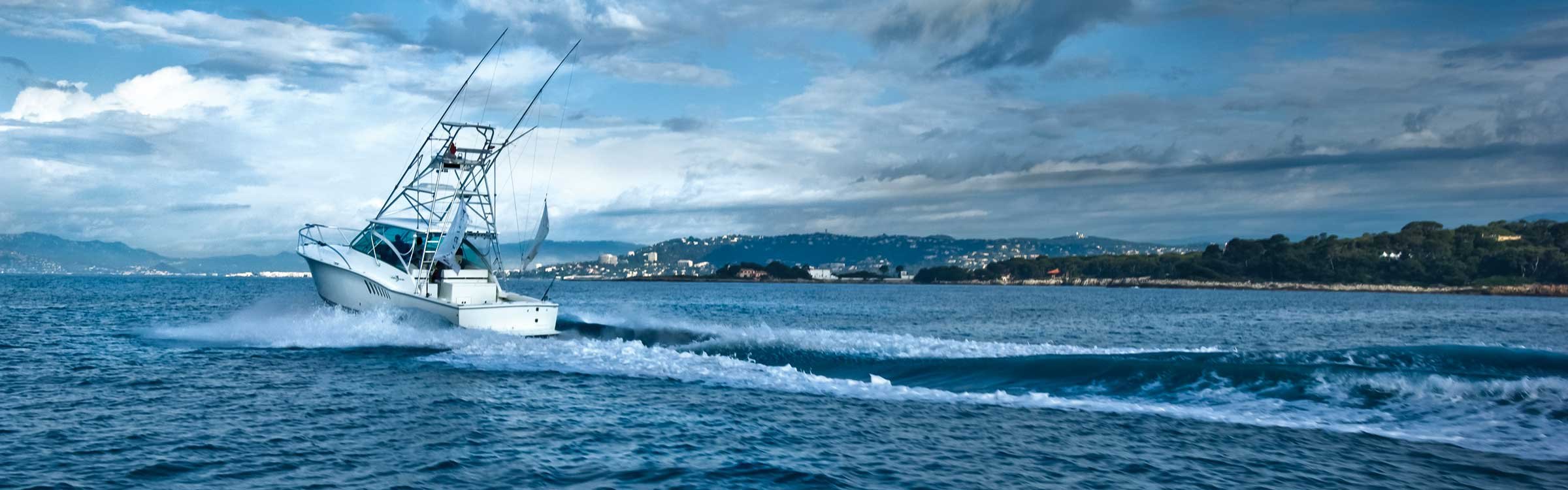
- Sonar
- Navigation
- Situational Awareness
- MEGA Imaging
-
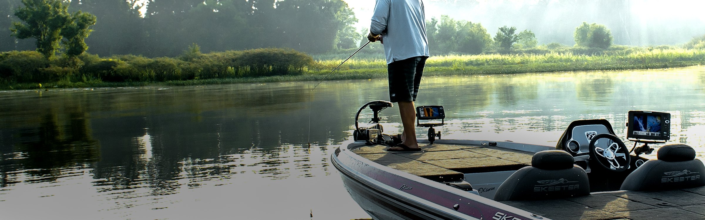
Look closely. You've never seen anything like new MEGA Imaging™. Delivering nearly 3X the output of standard Side Imaging®, this groundbreaking technology takes fishfinding into the megahertz frequency for the very first time. It's indisputably the clearest, sharpest sonar image ever-brought to you by the undisputed leader.
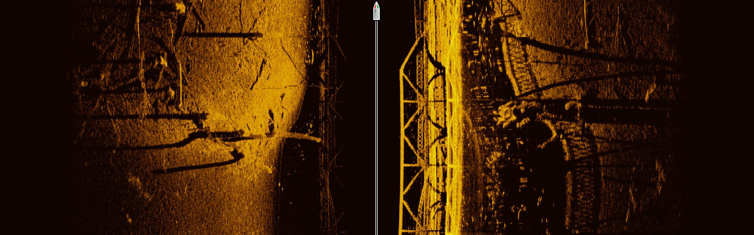 MEGA Imaging has you covered from multiple angles. Choose MEGA Side Imaging for an incredible view to the left and right of your boat. Opt for MEGA Down Imaging® for a crystal clear picture below your boat. Both technologies are built into select HELIX® 12, 10 and 9 G2N models.
 Some of the best fishing happens in depths less than 125 ft. And that's where the high frequency beam of MEGA Imaging shines brightest. In MEGA Side Imaging mode, you'll have coverage out to 125 ft on either side of your boat. For depths in excess of 125 ft and coverage out to 400 ft to either side of your boat, the blended beam gives you traditional Humminbird Imaging clarity.
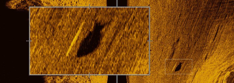 Zoom in to reveal a single fish and its shadow.
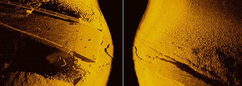 Note the individual stones surrounding this bridge.
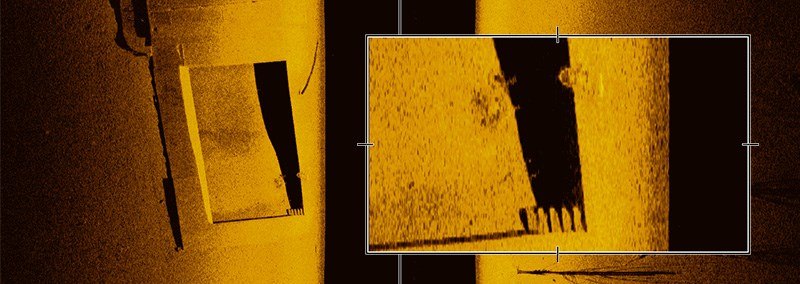 A bicycle is seen here on the edge of a submerged swimming pool.
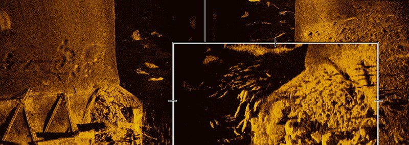 Observe the school of fish holding over this debris pile in zoom mode.
 - CHIRP
-
Only Humminbird lets you view low, medium and high CHIRP ranges, either individually or all at once. Dial in a specific kHz, search a defined range or cover the entire spectrum - it’s up to you. Because it uses a broader range of frequencies, Humminbird CHIRP also delivers extreme target separation, lower noise and richer, higher-resolution images and the power to reach depths of 10,000 feet (3,000 meters).

Simple as see fish, catch fish
Your fishing arsenal isn’t limited to one or two lures. No sir. It’s filled with options. Imagine your Humminbird® as a tackle box. You have a wealth of tools at your fingertips, each with its own job. And think of Humminbird CHIRP as yet another lure, with a specific task: showing you fish that other forms of SONAR cannot.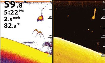 Nothing fishy here. With CHIRP, you can tell the difference between a sport fish, a baitfish and a weed based on the finely detailed arches.
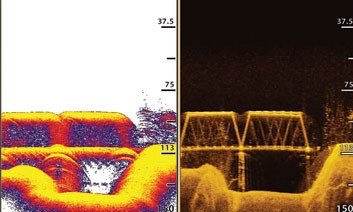 Don’t miss a thing. Thanks to the precision of CHIRP, you can clearly identify subtle structural details, like bridge cables, that can clue you into where the fish are.
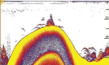 Filter out the nonsense. CHIRP sweeps multiple frequencies to eliminate confusing noise and interference. For example, see separation between fish and brush.
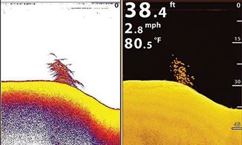 No more “blobs.” In traditional 2D SONAR, it can be difficult to tell where one object begins and another ends. It won't work with CHIRP.
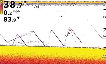 Dial it in. CHIRP allows you to select individual frequencies, enabling you to see the smallest details. For instance, monitor your jigging action on screen.All forms of CHIRP are not created equal. While competitors were flooding the market with technologies that barely qualify for the term, Humminbird was developing and perfecting a true Broadband CHIRP worthy of its innovative legacy. Humminbird did not cut corners - with full broadband capabilities built into the HELIX™ 12 Series CHIRP models. And while the competition picks just a few frequencies for you, Humminbird gives you full spectrum capability, plus the power to select your own start and end frequencies.
 Get to the bottom of it. By blasting more energy below the surface, CHIRP SONAR can take you to extreme depths with greater accuracy.
 Unless you have a PhD in SONAR interpretation, raw CHIRP information is meaningless without the right software to connect the data points. Humminbird’s CHIRP Processing Engine uses proprietary algorithms to more efficiently compare and crunch CHIRP data
 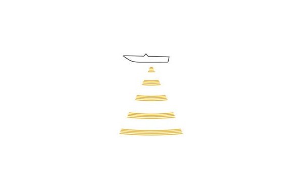 Traditional transducers put you on hold, wasting valuable time “charging up” before each SONAR pulse. Humminbird CHIRP transducers are engineered to minimize charge time, firing off more pulses in a given period of time. More pulses mean more information Humminbird Broadband CHIRP delivers impressive detail and accuracy in virtually any freshwater application. Compared to peer technologies, this best-in-class CHIRP sweeps more frequencies, while using superior transducer and data processing to deliver unrivaled fish-finding precision. For maximum convenience, this 1kW technology is built into your Humminbird HELIX 12 head unit.
- 1kW / Built-in
- Range of 28kHz-490kHz on the HELIX 12 DI to a range of 28kHz-250kHz on the Helix 12 SI and GPS. Depths down to 3,500 ft
For deepwater applications, up the ante with HD Broadband CHIRP. You’ll be able to target frequencies from 42kHz to 210kHz, sweeping low, medium and high ranges, with coverage down to 10,000 feet. This fully networkable, 2kW powerhouse is offered as a black box addition to your Humminbird ONIX® or ION™. - 360 Imaging
-
Revolutionary Humminbird® 360 Imaging™ offers a detailed, 360 degree view around your boat. Visualize it as a thin sonar wall extending 150 feet to either side of your vessel. This wall rotates to create a 300-foot circle enabling you to see areas virtually impossible to reach with other types of sonar. And, because the sonar wall moves, you don't have to, so you can see where fish are, before they see you.

For greater on-water flexibility, 360 Imaging lets you choose from five beam speed settings. Lower beam speeds lead to higher image quality but lower refresh rates. Conversely, higher beam speeds result in lower image quality but higher refresh rates. With five options, you can find the ideal setting for your boat speed, water conditions, and need for detail.Want to get the most of 360 Imaging and its unprecedented coverage area? You're in the right place. We've broken down several screenshots to help you make sense of this revolutionary technology.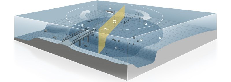
- A- Boat Location. Located in the center of the screen, rotating beam.
- B- Beam Location in a 360 degree radius around the boat.
- C- Water Column. The dark circle around your boat shows what's directly below you.
- D- Flat Terrain. Neutral shades of blue.
- E- Rising Terrain. Lighter shades of blue.
- F- Descending Terrain. Dark shades of blue.
- G- Cover and Structure. Objects standing off the bottom appear as a bright shape with an adjacent, dark sonar "shadow." The length of the shadow indicates the objects height.
For the first time ever, you can see up to 150 feet in front of your sonar pod, either in full 360 mode or by isolating your sweep area. New 360 Imaging allows you to isolate your sweep area of water from 10 to 360 degrees. You can lock in your beam anywhere - but the area in front of your boat is especially useful. With valuable intelligence on fish-holding structure and cover waiting up ahead, you can cast to productive areas without spooking fish. Because your beam has less ground to cover, you'll also benefit from a faster refresh rate.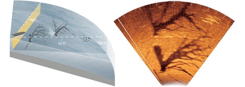
- Side Imaging
-
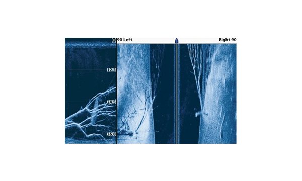
It’s all in the details. Gain a 180 degree side-to-side perspective on the world below the surface with remarkable Humminbird® Side Imaging®. In an instant, the ultra-thin beam scans the area up to 240 feet to the left and right of your boat location—for total coverage of up to 480 feet. The return image for each slice is then added to the images taken immediately before and after to build an incredible view of the lake bottom. You can then magnify the detail of the image with the zoom feature or mark the GPS location of promising cover or structure directly on the screen. Side Imaging's high-frequency beams reveal structure, cover, and contour changes with crystal clarity. The images are so real you might think it’s a camera, but it’s not, so it doesn’t matter how murky the water is.
 Understanding a few simple concepts will help you grasp the detailed images of Humminbird Side Imaging and make you a master of the lake or sea bottom. Compare the screenshot and diagram to help visualize how Side Imaging works. Humminbird has included several callouts to explain what you’re seeing. Remember, Side Imaging is a history of what you’ve already passed by.
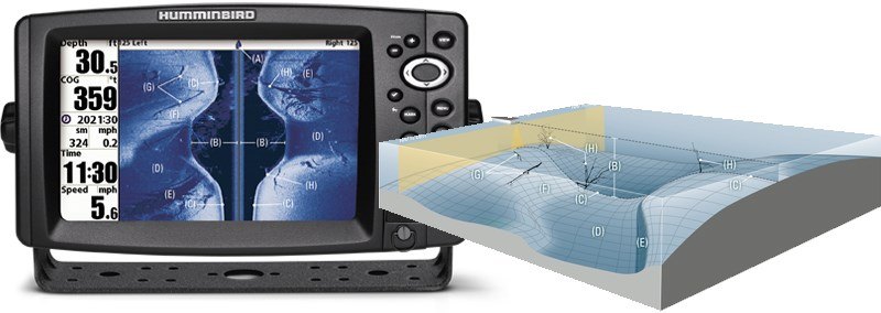
- A- Boat Location. The position of your boat in relation to the on-screen image. The on-screen image is a history of what you have passed over.
- B- Water column. The dark blue area shows structure, cover and activity between the surface and lake bottom.
- C- Bottom Profile. Reveals depth and terrain directly beneath the path of your boat.
- D- Flat Terrain. Neutral shades of blue represent flatter terrain.
- E- Descending Terrain. Dark shades of blue represent descending terrain.
- F- Rising Terrain. Lighter shades of blue typically represent terrain rising from the bottom. Sometimes, very hard bottoms appear as a whiter shade.
- G- Fallen Log. The shortened horizontal shadows indicate cover very close to the bottom of the lake. The angle of the shadow gives away the orientation of the log.
- H- Standing Timber.
Objects standing off the bottom directly below the boat will appear in the water column. Structure to the left or right of the boat will appear as a clearly defined bright shape with an adjacent, dark sonar "shadow." This shadow is not caused by light; rather it's the lack of sonar return because the object has already reflected the sonar energy. Generally, long shadows indicate the object is tall, and small shadows indicate something is short. It's important to note the shadow will often tell you more about the object than the primary sonar reflection. Reading the image produced by Humminbird Side Imaging is easy. Simply visualize the screen folded in half down the middle (behind the boat). Then, fold the image again at the lowest point of the water column.
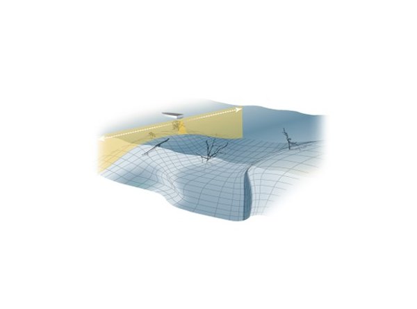 Humminbird Side Imaging Sonar uses a razor thin beam to take a “sonar snapshot” of the area up to 240 ft. to the left and right of your location. The return image for this slice is then added to the images taken immediately.
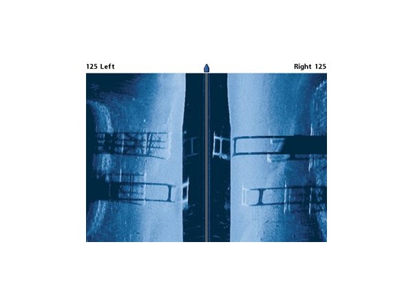 Submerged bridge pilings on lake bottom.
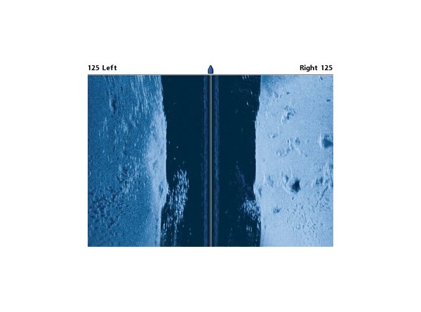 Side Imaging reveals balls of bait that you can use when targeting where fish are feeding.Storm the seas with a fully loaded Humminbird. Incredible Side Imaging® and Down Imaging® combine for a detailed, 180? view of the water. Dynamic SwitchFire™ Sonar shows you baitfish, thermoclines and other dead giveaways of where fish are hiding.
- Down Imaging
-
Sometimes, to catch fish, not only do you have to think like one, you've got to see like one. Get a fish-eye’s view of what’s happening below your boat with Humminbird® Down Imaging®. These incredible images are created with high frequency sound waves emitted in ultra-thin slices. The sonar returns from these waves produce a “portrait.” As you patrol the water, you’ll watch fish, reefs, timber, brush, bridge pilings, rocks, and any other structure or cover pop with stunning detail.
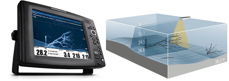 The detailed images of Down Imaging are created with high-frequency sound waves emitted in ultra-thin slices. The sonar returns from these waves produce a "snapshot" of what's below your boat.
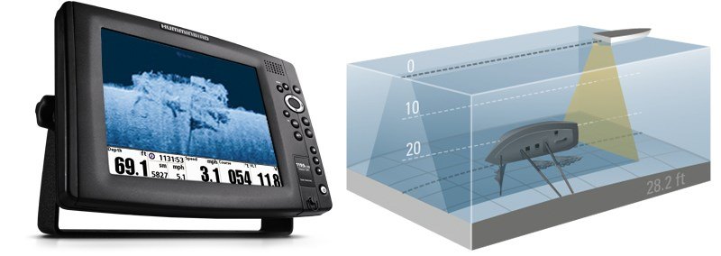 SwitchFire / Down Imaging. This view provides complete understanding of what exactly is going on below your boat. Quickly identify cover and structure with Down Imaging, while using SwitchFire® to locate and target fish. Together, they take the guesswork out of sonar fishfinding.
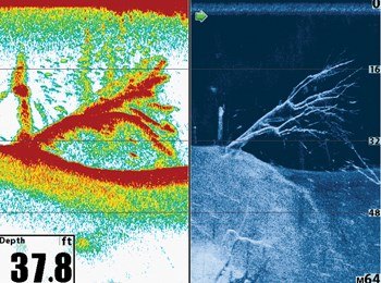
 Get a complete 180 degree view. Down Imaging provides incredible detail directly below your boat while Side Imaging® extends 240 feet to either side of your boat. These two detailed images are unlike anything you've ever seen.
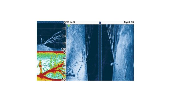 Use the split screen feature to view you lake charts with the Down Imaging sonar simultaneously.Don't miss a thing with these three Humminbird technologies working together. Use SwitchFire and Down Imaging together for a stright down view, while Side Imaging reaches out to both sides.
 - SwitchFire
-
Building on Humminbird legacy of sonar innovation, exclusive Humminbird® SwitchFire™ puts anglers in complete command of how their sonar returns appear. With two unique display modes, you can adjust to your fishing conditions on the fly. Add or remove detail; account for water depth, temperature and turbulence; even experiment with lure presentations - all at the push of a button. SwitchFire adds a whole new dimension to 2D fish-finding. It’s one more reason Humminbird is simply, clearly, better.
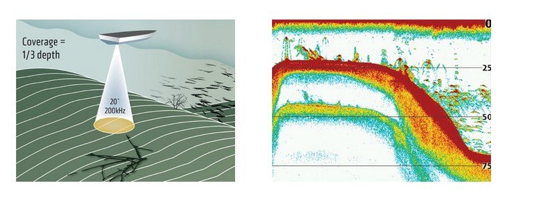 Humminbird Single Beam Sonar gives you a precision, 20º down-looking beam optimized for the best image of the bottom and structure.
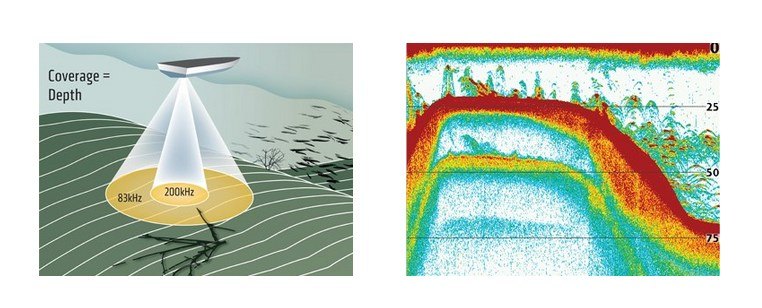 Two beams combine great detail and a wide coverage area. Use the narrow beam for high-accuracy returns of fish, structure, detail and the bottom profile. Opt for the wide beam when you want a larger search area.
 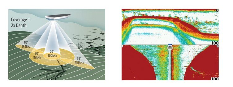 Full 90-degree coverage will give you a major advantage. 20-degree and 60-degree beams shoot below the boat, while two fan-shaped 35-degree beams look to the left and right—for precise fish placement below and to either side.
 - Digital Signal Processing (DSP)
-
Digital Signal Processing (DSP) is mathematical data manipulation technology. Sonar products produced by Humminbird® use transmitters and receivers that produce actual analog sound pulses and bounce them off objects, such as suspended fish and the bottom, and these analog signals must be converted to a digital format using an Analog-to-Digital converter in order to be understood by the sonar processor.
That's when the real magic of DSP technology can be used. DSP utilizes advanced computer algorithms to manipulate the (now) digital data to filter, reduce noise, finely tune and enhance sensitivity of sonar data which equals a clearer screen, greater target separation, and more productive fish finding.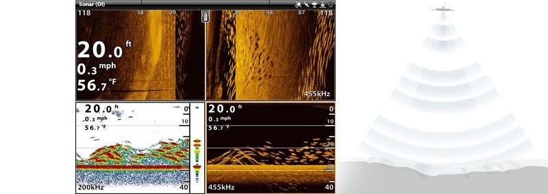
- GPS
-
Get unparalleled GPS technology out of the box. Many Humminbird fishfinders have the powerful Precision GPS/WAAS receiver built right in and provides fast position fixes accurate within 2.5 meters. For those models without it, there are several options:
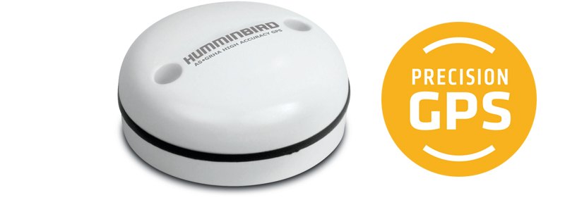
- Add the Humminbird Precision GPS/WAAS receiver for permanent GPS capability on your boat.
- Use Humminbird’s adapter and the NMEA output on your own handheld GPS unit, or use Humminbird’s InterLink to allow two fishfinders to access one GPS receiver.
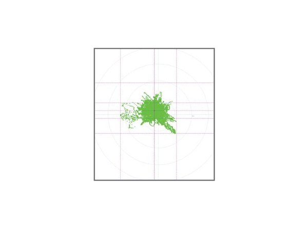 Humminbird Precision GPS provides a more accurate position fix than the industry standard GPS.
 A 24 Hour position plot using an industry standard GPS.
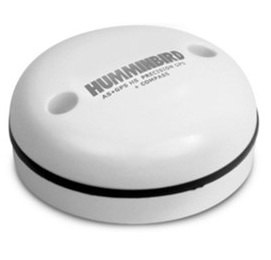 AS GPS with Heading Sensor includes an internal compass that always knows true North. This allows for a more precise readout of boat position and direction and assists in maintaining that accuracy when traveling at slow speeds (under 3 miles)
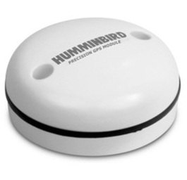 Precision GPS/WAAS receiver provides fast position fixes accurate within 2.5 meters. Provides more accurate position fixes than the industry standard GPS.
 - i-Pilot Link
-
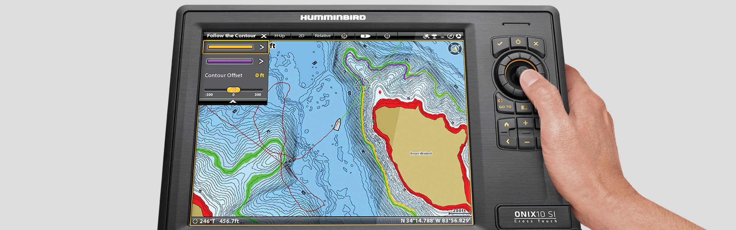
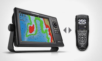
The i-Pilot® Link™ Integrated GPS Trolling System enables your Humminbird fishfinder and Minn Kota® trolling motor to communicate, delivering automatic boat control. From your Humminbird or the wireless remote, you can find, store and revisit your most productive fishing spots and tracks. With an AutoChart or Lakemaster map, you can follow any depth contour you choose, automatically, or cast to it from a set distance.
 A full-color LCD screen displays current function, user menus, GPS signal strength, prop status, battery state, water depth and temperature.
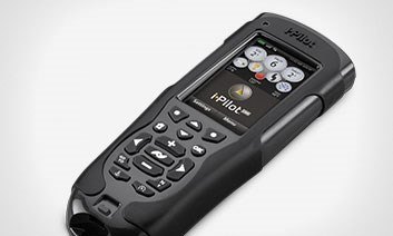 Powered by a rechargeable battery, the remote is waterproof and floats. i-Pilot Link can learn multiple remotes for added flexibility.With i-Pilot Link, you can take command from the wireless remote or your Humminbird. And once you do, the possibilities are endless: lock onto spots, learn and retrace paths and depth contours, and more. All with the ultimate GPS fishing system.
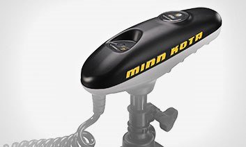 i-Pilot Link installs quickly and simply. Just replace the top of your i-Pilot Link-compatible trolling motor head, activate your remote and you’re ready to fish.
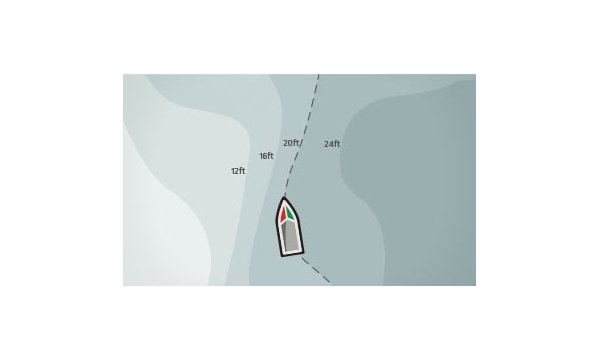 The unique Follow the Contour feature directs the trolling motor to follow a specific depth contour, in either direction, that is displayed with a compatible Humminbird LakeMaster or AutoChart map.
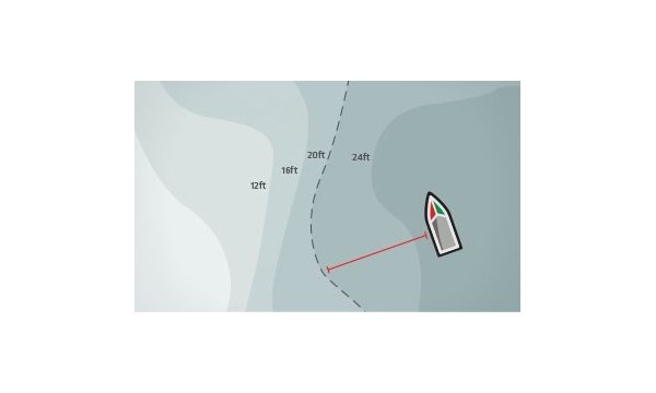 Fish at a certain distance away from a depth contour or the shoreline. Select your contour and the distance you’d like to offset it. Now you can present the bait to a specified depth and cast to it.
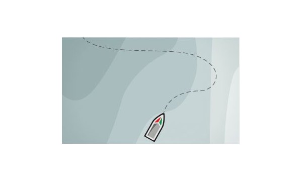 iTracks are trolling paths in the water (up to two miles long) that you can record, store and retrace at any time, in either direction. If you want to return to a stored iTrack, use the Go To feature.
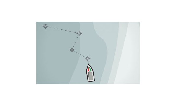 String multiple Spot-Locks and waypoints together to create a custom route that i-Pilot Link can automatically navigate in either direction.
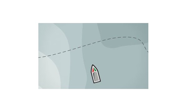 Return to any saved Spot-Locks, iTracks and waypoints at the push of a button. Just select the spot or path you want to return to, and Go To will tell your trolling motor to take you back to it automatically.
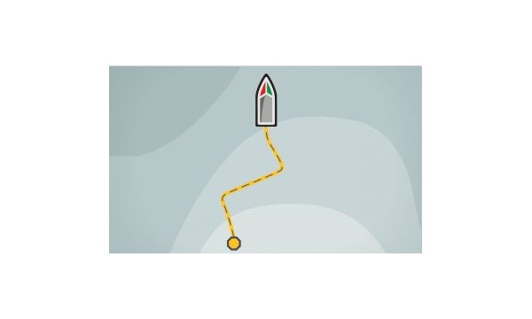 Navigate the current track as a recorded iTrack. When BackTrack is selected, the i-Pilot Link will mark a start point at the boat’s current position, and it will create an iTrack on top of the current track, and automatically retrace it.
 - AutoPilot
-
Never deviate from your route with the precise control and proven performance of your Humminbird® Autopilot™ system. Easily navigate the SC 110 User Interface thanks to intuitive keys and menus, and a full-color, sunlight-readable display. This rugged pilot features advanced steering control technology that holds its course even in high winds. Let it take the helm with total confidence, whatever the sea’s conditions.
Take the Simplest Course
An Autopilot should make reaching your destination less complicated - not more. That’s the thinking behind every feature of the Humminbird Autopilot. In seconds, set your heading or turn pattern and maintain your desired route, regardless of speed or sea and wind conditions.Fully Integrated System
The components of the Humminbird Autopilot System add up to superior course stability and steering performance, not to mention reduced fuel use. Combine them with a Humminbird navigation system for total authority on the water. True Course uses GPS position and course-keeping algorithms to compensate for set and drift influences. The result is the steadiest possible course - automatically.
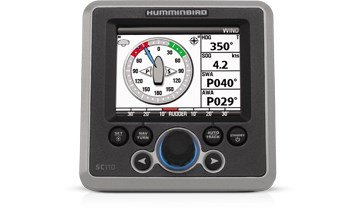 Maintain your desired point of sail with continuously updated Apparent and Set Wind angle indication. This results in better steering in all wind and sea conditions. Use graphic close-hauled indication for quick reference.
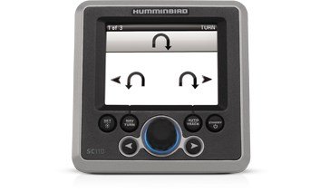 You focus on catching fish - let your Autopilot do the steering. Choose from pre-programmed turn patterns designed specifically for sportfishing.
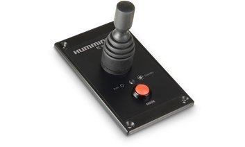 Easily perform fast action maneuvers. When you’re finished, release the joystick and the Autopilot resumes to the set course. You can also use it to point the boat to a new course.
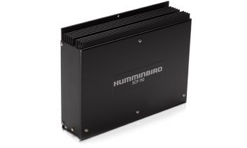 The high-speed, highly reliable SCP 110 optimizes rudder movement by working with the integrated GPS speed, Fluxgate Compass and Rate Gyro.
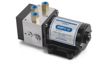 Built with the finest components and ideal for crafts of all dimensions, Humminbird Pumps feature a full range of flow rates, pressure ratings and oil tank capacities.
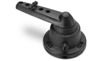 This brushless RFU features a unique, linear variable transformer- providing decades of reliable performance.
 This reliable electronic compass maintains your course based on magnetic heading reference.
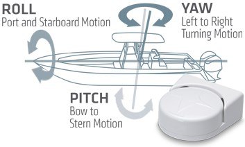 Stabilize your Autopilot, radar and chartplotter with this solid-state, three-axis heading sensor. Combines a digital compass, three-axis accelerometer and rate gyro to achieve one to two degrees of dynamic heading accuracy, even in rough seas.
- CHIRP Radar
-
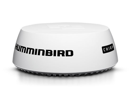
Introducing the next generation of marine radar: new CHIRP Radar, featuring CHIRP Pulse Compression. Setting a new standard for compact solid state radar, this technology delivers superior radar imaging on both long and extremely short ranges. This translates to better situational awareness in low-visibility conditions, and helps identify birds and floating obstacles for clues to where gamefish are located. You can also track weather and vessels with amazing definition. Compatible with select Humminbird HELIX and ONIX networking models.
 Along with excellent short-range detection (18-ft minimum range), CHIRP Pulse Compression ensures more energy reaches each target for superior imaging at long ranges up to 24 nautical miles. CHIRP Pulse Compression identifies small or weak targets, even while positioned close to strong returns.
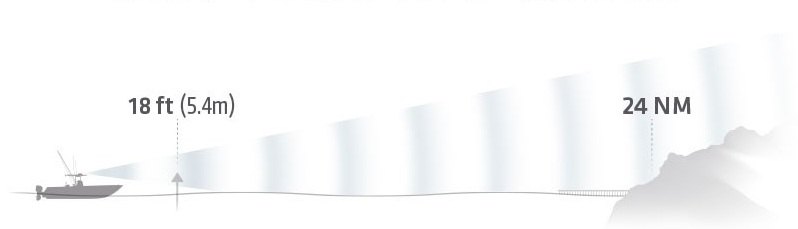
 Thanks to solid state technology, Humminbird radar is safe, reliable and lightweight. At 12.3 lbs, the radar unit weighs 50% less than traditional magnetron radars and offers safe emissions with a low power radar transmitter. It's ready to use in seconds
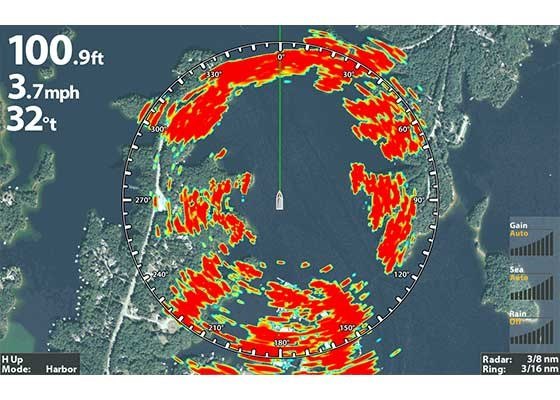 See things more clearly with Humminbird CHIRP Radar. Shorelines, buoys, other boats and weather-watch it all take shape on your display for maximum safety and a competitive edge.
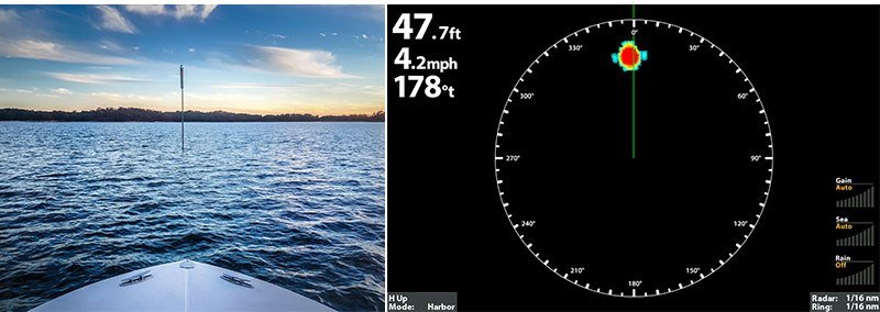 This hazard marker shows up clearly at only 20 feet from the bow.
 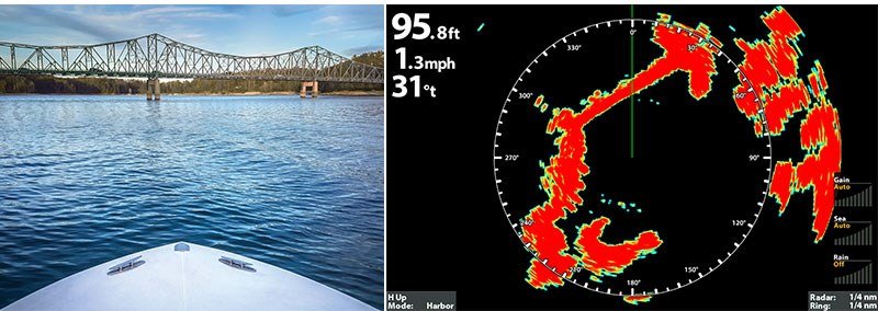 Clearly identify this upcoming bridge with the precise imaging of Humminbird radar.
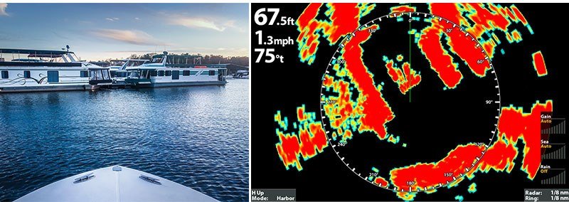 Advanced target separation allows you to see individual vessels within a crowded marina.
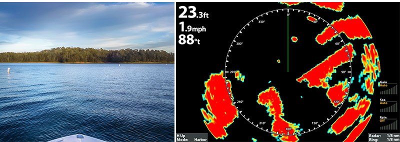 Clearly note even small structures such as the three buoys shown in this radar image.
 - AIS
-
Every day on the seas has the potential to become a life-changing experience - and not always the good kind. From poor weather to high-traffic channels to sudden changes in engine performance, Humminbird can help you stay informed, safe and productive. Use Humminbird radar to maneuver in low visibility and identify clues to where the fish are.
Battle fish - not other boats. Track other vessels with Humminbird’s state-of-the-art AIS technology. It takes the risk and guesswork out of navigating high-traffic channels or low-visibility seas. From your Humminbird display, you’ll see key information transmitted by other AIS-equipped vessels in VHF range of your boat. If you choose, other vessels will be able to view the same information about you. See. Be seen. Never be sorry.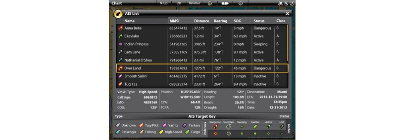 Humminbird AIS technologies deliver peace of mind right out of the box. Bright LED indicators and high-visibility displays keep you informed and alert to your conditions. All AIS accessories feature rugged, saltwater-proof construction for years of safety
Up to 100 Targets
Display and track critical safety and navigation statuses of up to 100 AIS targets at once.Silent Mode
See other vessels near you without being seen. By pressing a button, you’ll continue to receive AIS messages from all transmitting vessels in your area, but your boat’s AIS transmission will be suppressed.Simple Presentation
Easy-to-decipher graphics and text give you an instant understanding of your surroundings.In-Depth Vessel Information
See name, location, type, length, beam, draft, cargo type, destination and estimated time of arrival of other AIS vessels.
 AIS-SART Beacon. Your best option in a worst-case scenario. This easy-to-operate Search and Rescue Transponder (SART) sends unique alerts to all nearby AIS-enabled equipment. Transmit data includes exact GPS location, target tracking range and bearing for
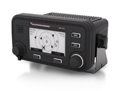 Want it all? Get the most detailed AIS data and a faster update rate with this professional-grade transceiver. View AIS information directly on the LED backlit LCD display and easily find what you’re looking for with the intuitive menu system. Includes ex
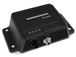 Just the facts. Send and receive basic AIS information with this Class B transceiver, equipped with internal GPS receiver for accurate position data output. Offers USB, NMEA 2000® and NMEA 0183® connectivity.
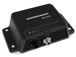 Sometimes, it’s better to receive than give. With this dual channel Class B receiver, you’ll get AIS information about other vessels, while keeping your own data to yourself. Offers USB, NMEA 2000® and NMEA 0183® connectivity.
 Avoid the cost and hassle of a second antenna. Install this splitter to share a single VHF antenna with your VHF radio and Humminbird Class B transceiver. FM output allows you to also connect a FM broadcast receiver.
 - NMEA 2000
-
What started out a perfect day on the water can quickly turn ugly. From poor weather to high boat traffic to sudden changes in engine performance, Humminbird can help you stay informed, safe and productive. Tap into NMEA 2000® sensor data to monitor everything from fuel use to wind.
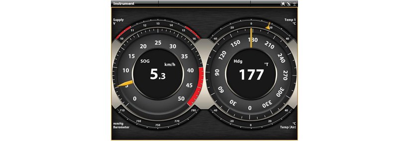
From boat performance to weather and water conditions, make sense of it all with Humminbird NMEA 2000 Networking. Easily connect sensor after sensor to your vessel’s Humminbird system. Bearing, depth, engine status, tank level, electrical - you name it, Humminbird can display it. Conserve valuable fuel, make informed decisions and see red flags with an at-a-glance view of all relevant information.Multi-Sensor Support
Display and easily interpret virtually any NMEA 2000 sensor with intuitive, high-color graphics and text. You can even view data for multiple engines and fuel tanks.Simple Customization
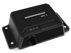
Easily customize data boxes to suit your fishing and navigation situation. Focus on a single reading or view multiple gauges at once for a more complete picture. This waterproof black box allows you to create a NMEA 2000 network using your Humminbird HELIX 9, 10, 12 as well as the 1100, 900 or 800 Series fishfinder.
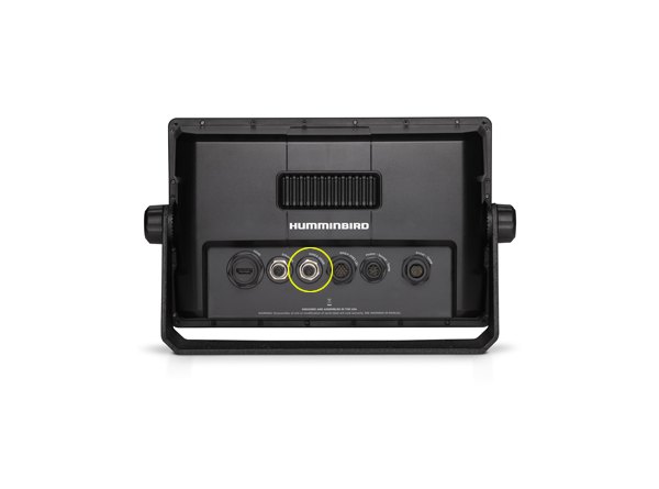 Plug your NMEA 2000 network backbone directly into your ION™ or ONIX™ display. No adapters or black boxes required. 3rd port from the left.