
- Basemap
-
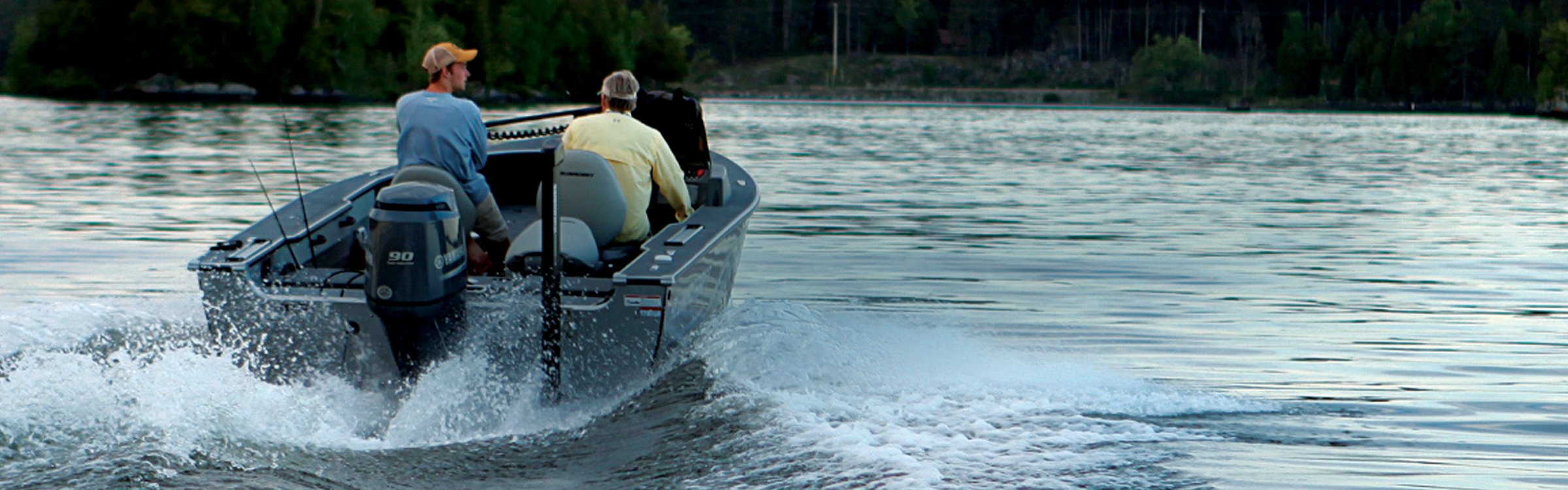
Humminbird has enhanced standard basemap to deliver more detail and a superior angling experience. Built into GPS-equipped HELIX™ Series G2 and G2N models and based on current data from LakeMaster®, NOAA and other trusted sources, these accurate maps provide you with a clear view of underwater terrain and surrounding points of interest so you can fish and navigate with total confidence. A new standard has been set.
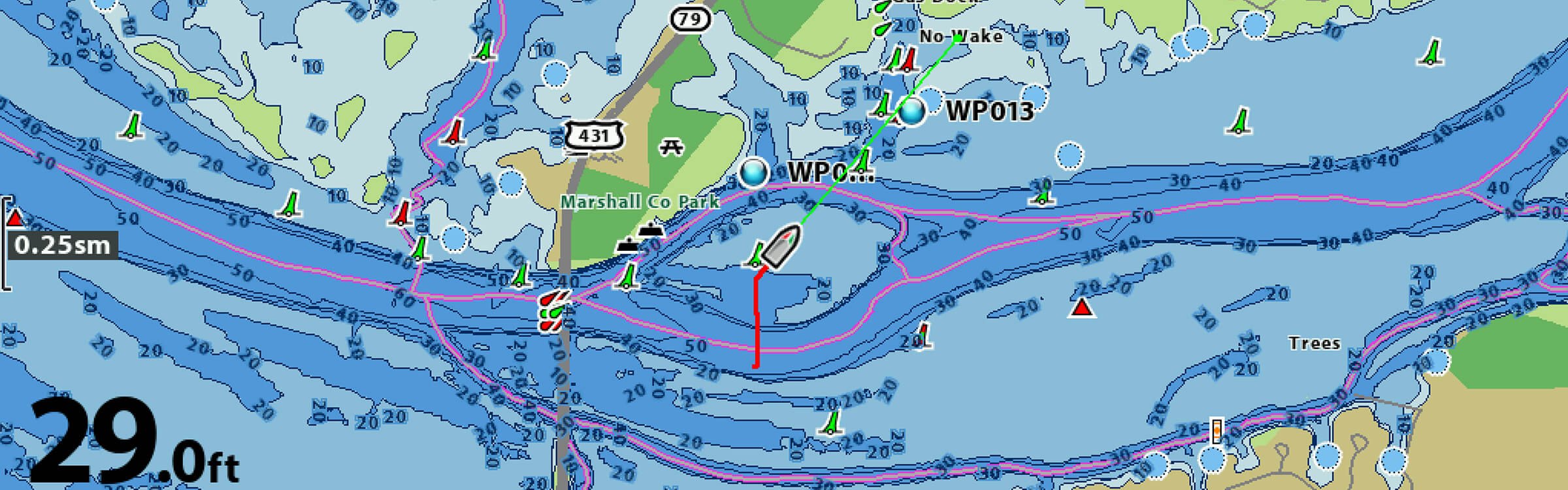
The new Humminbird Basemap is available as a built-in feature of the GPS-equipped HELIX Series G2 and G2N models. Combine this detailed Basemap with other powerful Humminbird technologies, including MEGA Imaging™, CHIRP Digital Sonar and radar, for an unmatched understanding of the water.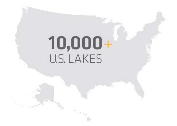 If freshwater is where you make waves, you've come to the right place. The new basemap includes contours, navigation aids and points of interest for more than 10,000 U.S. inland lakes. You'll also have shorelines for hundreds of thousands more
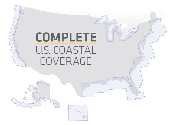 Looking to fish the coast? Humminbird Basemap offers precise charting data for the entire U.S. coast, using the most trusted name in saltwater navigation as the primary data source - NOAA. Anglers are able to quickly identify more than 200 icons and spots
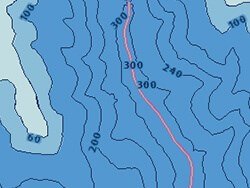 Depth Contours. Know your depth and identify fish-holding areas with help from more than 10,000 U.S. inland lake maps.
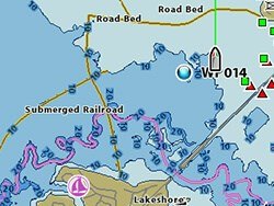 Points of Interest. Spend more time fishing and less time searching with listings of docks, marinas, boat ramps and more for your body of water.
 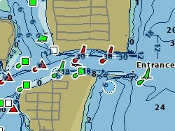 Navigational Aids. Navigate more confidently with this comprehensive icon system identifying buoys, lights, obstructions, wrecks and more.
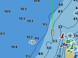 Spot Soundings. Make your time on the water safer and more productive with spot soundings for the entire US coast.
 - LakeMaster
-
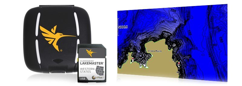
For decades LakeMaster® has been putting accuracy, detail, and a passion for angling on the map lead by a devoted team of GIS analysts, anglers, and surveyors alike. LakeMaster's partnership with Humminbird® is now beginning to break down more barriers than ever before. Humminbird LakeMaster mapping is not only growing in coverage area, but also expanding the possibilities of cartography. Together innovation continues to lead to new and exciting products, seamless integration between software and hardware, a relentless focus on helping anglers catch more fish, and a commitment to doing it all right here in the U.S.A.
 Accuracy and detail give anglers using Humminbird LakeMaster GPS Map Cards the best High Definition hydrographic maps on the market. More coverage means more opportunity for catching fish on your favorite bodies of water. These map cards are available in nine Humminbird compatible editions, providing lake maps in 33 states, parts of North West Ontario, and the Great Lakes.
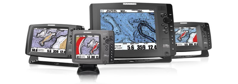
High Definition vs Standard Definition
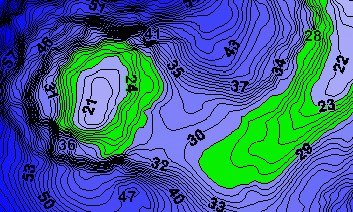
High Definition is ascribed to a chart by LakeMaster when the underlying data is of such high quality and density that the resulting map is very accurate. Only the most accurate and detailed surveyed data combined with the talents of Humminbird experienced GIS analysts earn the “High Definition” label. Humminbird Lakemaster High Definition lake charts have the highest level of accuracy, especially in the shallow “fishing structure” areas. In some cases, the bathymetric data to build the map has been gathered by LakeMaster’s own survey team. These lakes are identified as a “LakeMaster High Definition” chart.Contour Line Density
Spacing of contour lines does not determine if a map is high definition or not. LakeMaster uses 1-ft contours on most of Humminbird high definition maps, but not all. On some lakes that are deep and have steep break lines, 3-ft contour spacing might be used because the lines become so dense at 1-ft that it isn't functional. It’s still high definition i.e. “high accuracy”.High Definition detail is data often gathered by Humminbird own survey crew who spend tireless hours mapping year round. Their information is then processed by the experienced GIS team. The results are high quality, highly accurate 1 - 3 foot contour maps, sometimes as tight a 6” intervals, that provide anglers with the best fishing data available.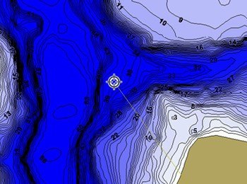 Standard Definition contours are usually in 3 - 5 foot intervals. These enhanced maps are made by LakeMaster using publicly available information. This general lake contour information becomes the basemap. Then, the G.I.S. analysts apply techniques to ensure accuracy of shorelines and update visible features to provide a general lake profile.
 The revolutionary patented features of Humminbird Lakemaster map cards offer new ways to enhance your fishing. Select a particular depth or range of depths using the Depth Highlight feature to keep you in the strike zone. Use Shallow Water Highlight to help identify hazardous areas or shallow fishing water. Water Level Offset lets you adjust the chart to the current water level. Can't locate the lake? Use the Quick Find LakeList and your chart screen will immediately go to your selected lake.
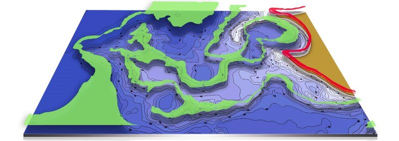
 Select a particular depth or range of depths using the Depth Highlight feature.
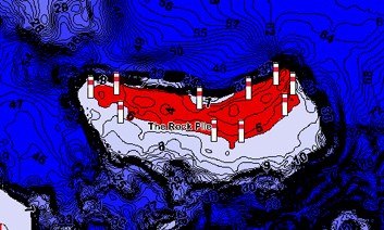 Use Shallow Water Highlight to help identify hazardous areas or shallow fishing water.
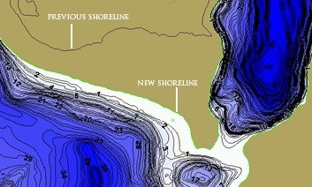 Water Level Offset lets you adjust the chart to the current water level.Bring the High Definition mapping of LakeMaster cartography to your computer for unparalleled fishing success. Humminbird Contour Elite™ PC Software uses advanced features and user friendly interface to give anglers a new way to approach fishing. Find fishing areas based upon fish species or specific season, weather, and water conditions. View the search results in 3D for the ultimate insight into the fishing structure. Print custom maps, measure distances precisely, Import & Export waypoints to/from major brands of GPS Devices, log fishing results and more! Available in nine editions that parallel the GPS map cards.
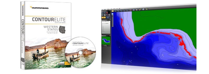
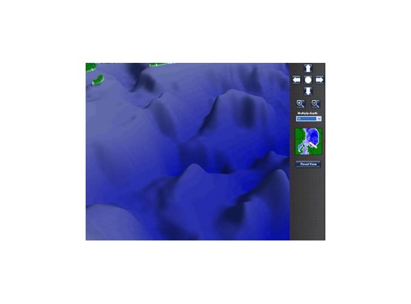 One of the most exciting features of Contour Elite is the 3D viewer. This tool allows you to view any part of the lake in 3D to better understand the underwater structure.
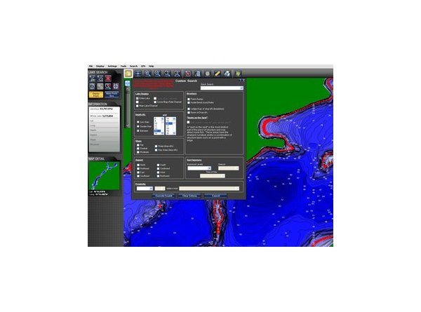 Contour Elite uses advanced search parameters within a user friendly interface making it easy to find new fishing spots. Results are then highlighted in red on the map allowing you to add or refine your search and export locations.
 - LakeMaster PLUS
-
The Humminbird LakeMaster PLUS series is a new family of digital GPS map cards that parallel the standard Humminbird LakeMaster map card editions. PLUS map cards have all of the same features you’ve come to love from LakeMaster such as Shallow Water Highlight, Depth Highlight, Water Level Offset and Follow the Contour. PLUS cards also include the same coverage area, lake lists, and compatibility with most Humminbird GP models as there standard counterparts.
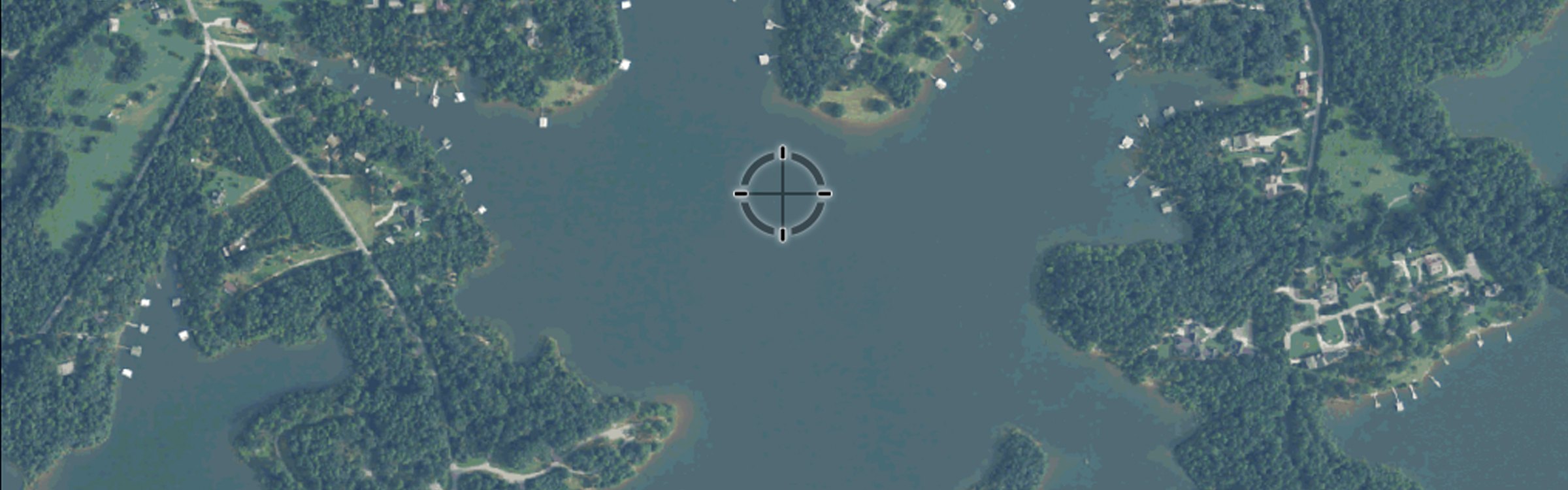
The Difference is the PLUS series allows anglers the ability to use aerial image overlay on High Definition waters. Anglers now have the ability to use quality aerial photography to view the entry and exits of creek channels, see how far a reef or weed line extends, pick out shallow water rock piles, steep drop-offs and other features of the lake you’ve been missing from traditional maps.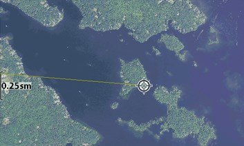 Satellite-Only Layer. Shows only aerial imagery and no other map information. Excellent for revealing an uninterrupted view of hidden structures in the water such as weed edges or sunken islands.
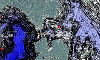 Satellite + Land Layer. Shows the LakeMaster map and the aerial imagery that extends around the body of water. This allows anglers to maximize the cartography options by getting the best of both worlds; the aerial imagery and 3D shading from LakeMaster.
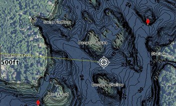 Satellite + Contours Layer. Shows the aerial imagery and just the LakeMaster contours so you can pick out all of those subtle features in the water while still seeing your depth.LakeMaster PLUS is a must for anglers looking to get the most from their cartography. Have the advantage of understanding all the underwater structures that each body of water you fish has to offer. All PLUS editions are micro cards with an SD adapter to fit a wide range of Humminbird models.
- AutoChart
-
Leave no waters uncharted. Proprietary software from the new Humminbird® AutoChart™ uses your Humminbird’s sonar returns and GPS to build your charts. Simply record that information onto the AutoChart Zero Lines map card (included), import that data into the AutoChart PC program which will convert it into a lake map. Once complete, transfer your new custom map back onto the AutoChart Zero Lines map card and it’s ready to display on any compatible Humminbird.*
No subscriptions. No hidden fees. No need to submit your data and wait weeks for a finished chart. AutoChart does it instantly - and your data is kept private, so your competition is none the wiser.
*Optional for select ONIX, ION, 1100, 900, 800, 700, 600 and HELIX Series models.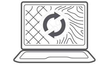 Transfer the saved survey data from your Humminbird to your PC via the AutoChart Zero Lines map card (included). AutoChart will convert that data into a detailed map.
 Travel back and forth then up and down water in a zig-zag pattern with your Humminbird in record mode.The Zero Line is the place where the water meets the shore. Humminbird AutoChart includes a map card loaded with Zero Lines for millions of water bodies. With these all-important Zero Lines as your foundation, you can begin creating your own accurate and detailed maps of any fishing spot. The Zero Line map card is also formatted to record your sonar logs. After recording, load the card into your computer to let the AutoChart PC Software convert the recordings into a map that can be displayed on your compatible Humminbird.
 Save the newly created map back onto your AutoChart Zero Lines map card for use in your Humminbird.The AutoChart DVD software for your PC is the powerful engine used to turn survey data into a sophisticated lake map. The map created by the AutoChart software can be viewed on the computer AND be exported back to the Zero Lines map card to be viewed on you compatible Humminbird unit. Now you can have your own map for that secret honey hole and keep it a secret.
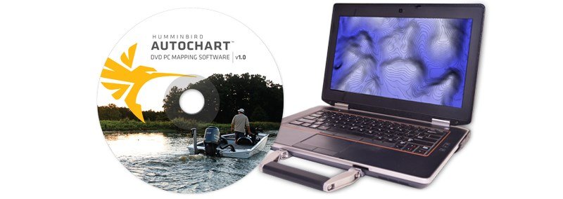 Now with the Follow the Contour feature of i-Pilot® Link™ on any lake when you create contours with AutoChart. Humminbird AutoChart enables you to use the Follow the Contour feature of i-Pilot Link on previously unmapped bodies of water after you create contours with this revolutionary PC software.
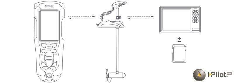
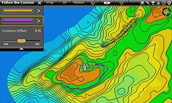
 With i-Pilot Link's innovative Follow the Contour feature, it directs the trolling motor to follow a specific depth contour. The chosen contour line can be automatically followed in either direction, or stay a set distance from it or the shoreline.
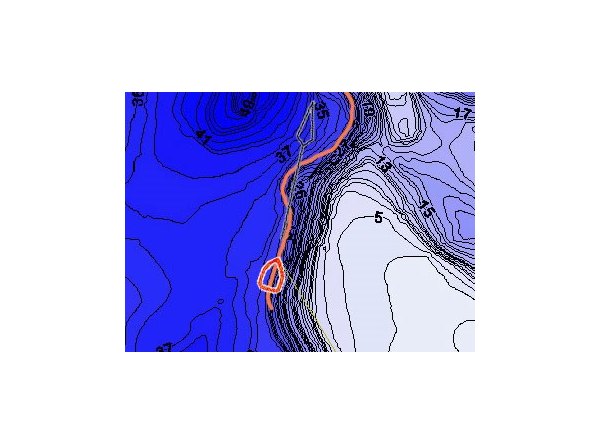 This screen shot shows a contour selected and i-Pilot Link automatically guiding the boat along it's course. This incredible feature is now available on what was once previously unmapped water- when data is surveyed and converted using AutoChart.
 AutoChart PRO
Add another layer of detail to your AutoChart cartography. New AutoChart PRO offers all the leading features of AutoChart - but with two key enhancements designed to give tournament anglers a competitive edge. Bottom Hardness Indication delivers a crucial tip-off to where fish are hiding, while Side Imaging Mosaic allows you to overlay your Side Imaging returns onto your AutoChart map for a 3D visualization of fish-holding habitat. With AutoChart PRO, you'll have all the tools necessary to bring your next trophy in sight.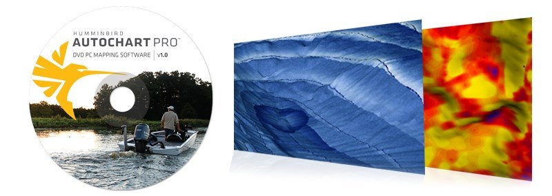
- AutoChart Live
-
Create richly detailed maps of your favorite fishing spots in real-time with Humminbird®'s patent pending AutoChart® Live, a free feature available with all SOLIX and HELIX G2N and G2 models. Map the water as you drive the boat, with eight hours of built-in recording time. No added fees. No need to upload your data for the world to see. The future of digital charting has arrived.
 Navigate with the detail and exclusive features of Humminbird LakeMaster, identify hotspots with SmartStrike™ compatibility and map any lake with standard AutoChart Live capabilities, all available on SOLIX units. Use optional i-Pilot Link to automatically follow map contours
 Follow your newly created depth contours automatically. All maps built with AutoChart Live are compatible with i-Pilot® Link™ features.
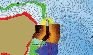 Once you've created your new maps, import to your computer and overlay them with Side Imaging® or 360 Imaging® to create a custom, detailed view.
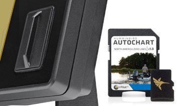 Humminbird units with AutoChart Live come equipped with up to eight hours of internal recording time. For years of recording, you will need to purchase a ZeroLine SD Card.
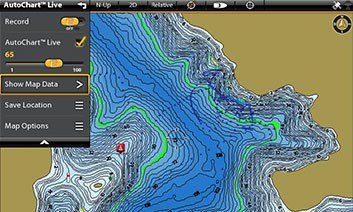 Highlight Depth, Shallow Water Highlight and Water Level Offset - all these rich features in AutoChart Live
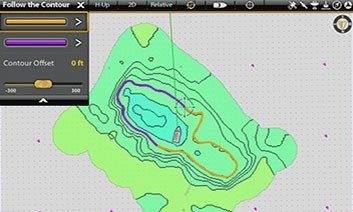 Map artificial reefs, moving tidal cuts and channels with up-to-the-minute accuracy.
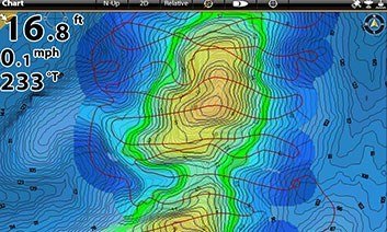 You can also overlay your AutoChart Live maps on existing LakeMaster® or Navionics® charts to reveal new details.
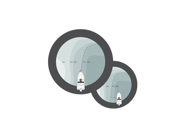
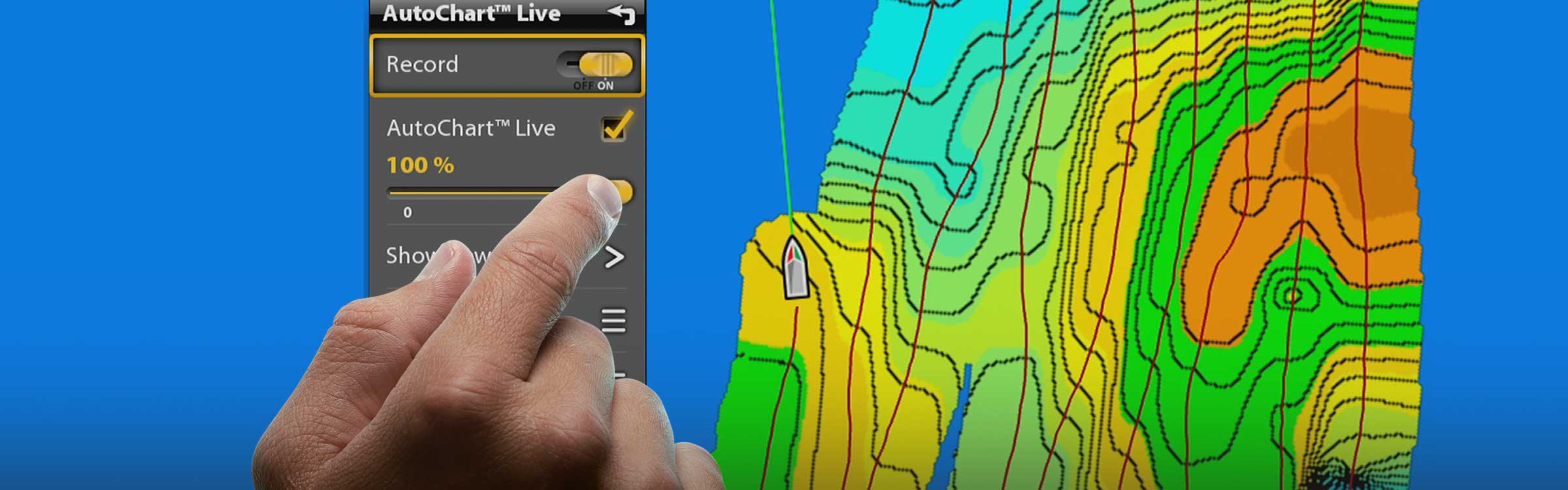
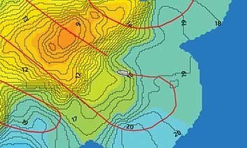 AutoChart Live draws a map of your lake's depth contours-complete with actual depth labels-as you drive your boat.
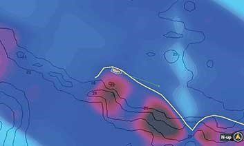 Now the detail goes even deeper. AutoChart Live uses sonar to measure and chart bottom hardness, tipping you off to likely hotspots.
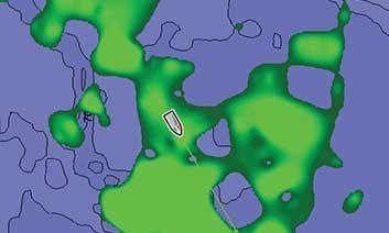 The weedline can no longer hide. With help from your sonar beam, AutoChart Live can now instantly map weeds, brush and other vegetation.
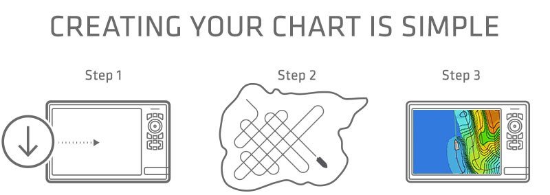
Step 1: Make sure you have the latest software
If you have purchased a SOLIX or HELIX G2N model, good news! You are ready to start charting depth, vegetation and bottom hardness levels. If you have a HELIX 5 or 7 G2 model, you'll want to make sure you have the latest software. Sign up for a myhumminbird account and register your Humminbird model. Then, go to your account page to ensure you have the latest version of software.Step 2: Turn it on and Go
From any chart view, choose menu and select the AutoChart Live tab. Press record and you're ready to make a map. Now start driving back and forth over the water, as if you were mowing your lawnStep 3: Your Map Appears
Watch your own AutoChart Live map appear before your eyes, live on your screen. You now can begin using exclusive Humminbird Lakemaster features and i-Pilot Link Follow the Contour.The ONIX, ION, and HELIX come with enough memory to record up to 8 hours of data . If you need more, then you will need to purchase the Zero Lines Map card. The Zero Lines Map card will give you years of record time as well as the ability to share maps with your friends. Check out AutoChart Pro and AutoChart PC for even more mapping features.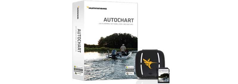
- SmartStrike
-
Get advice the locals won't give you with a Humminbird® SmartStrike™ map card. Based on search parameters like season, time of day, temperature and fish species, SmartStrike highlights areas of the lake map where fish are most likely to be biting-before you even wet a line. No more guessing or wasted casting. Just fishing. Exclusive to Humminbird LakeMaster® High-Definition inland freshwater systems, and compatible with the Humminbird ONIX® and ION™ Series, and select HELIX™ Series models in March 2016 (software update required).
Predict where the fish will be next with Humminbird SmartStrike. Set your search parameters, specify your target, and your Humminbird will plan your attack in seconds. It's like having your own personal fishing guide with decades of experience in the boat with you. The SmartStrike map harnesses Humminbird LakeMaster map data and extensive search algorithms to help you pattern and locate fish.
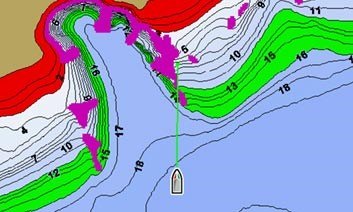 SmartStrike gives you access to Shallow Water Highlight, Depth Highlight and Water Level Offset, all exclusive features of Humminbird LakeMaster.The chase is over-rated. Get down to business with help from Humminbird SmartStrike. Once your parameters are set, the results appear on the screen instantly, which means less time searching for those spots and more time fishing them.
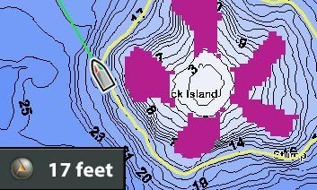 Find a fishing spot using SmartStrike, then lock onto a depth and Follow the Contour with your Minn Kota trolling motor using i-Pilot® Link™.
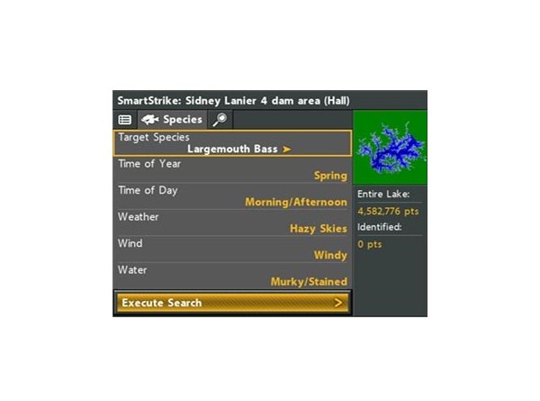 Instantly locate fishing hotspots where your preferred species is likely to be active based on current conditions.Fish with all the latest intelligence. Humminbird SmartStrike map cards are compatible with new Humminbird SOLIX, and select HELIX G2 and G2N Series. Also compatible with ONIX, ION Series, and select first generation HELIX models (may require software update).
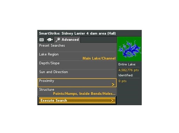 For an even more advanced search, you can highlight areas on the lake map that meet specific criteria for depth, slope and other parameters.